Dehgülan (Dehgolān)
Dehgulan (Farsça: دهگلان, Dehgolān, Kürtçe: Dêwlan), İran'ın Kürdistan Eyaleti'nde şehir.
İdari olarak Dehgulan şehristanı'na bağlıdır ve bu şehristanın yönetim merkezidir. Kentin 2017 yılı nüfusu 45.386 kişidir. Dehgulan, Senendec ile Hamedan arasındaki 46 numaralı kara yolu üzerinde bulunmaktadır.
İdari olarak Dehgulan şehristanı'na bağlıdır ve bu şehristanın yönetim merkezidir. Kentin 2017 yılı nüfusu 45.386 kişidir. Dehgulan, Senendec ile Hamedan arasındaki 46 numaralı kara yolu üzerinde bulunmaktadır.
Harita - Dehgülan (Dehgolān)
Harita
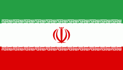
Ülke - İran
Döviz / Language
| ISO | Döviz | Sembol | Significant Figures |
|---|---|---|---|
| IRR | İran riyali (Iranian rial) | ï·¼ | 2 |
| ISO | Language |
|---|---|
| FA | Farsça (Persian language) |
| KU | Kürt dilleri (Kurdish language) |


