지도 - 몬트세랫 (Montserrat)

몬트세랫 (Montserrat)
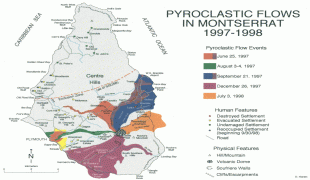
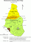
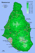
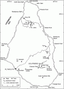
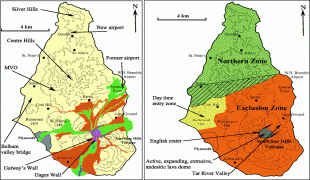
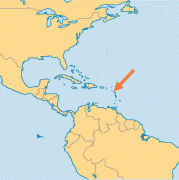
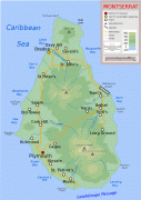
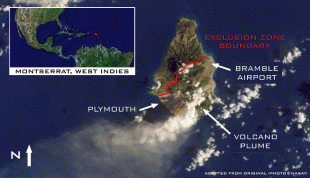
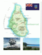
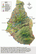
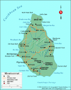
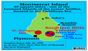
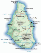
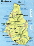
몬트세랫(Montserrat, )은 카리브해에 있는 영국의 해외 영토이다. 정식 수도는 플리머스이지만 1995년과 1997년에 있었던 화산 폭발로 인해 파괴되었고 현재는 브레이즈가 사실상의 수도 역할을 한다.

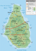
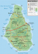
이 제도에는 길이가 약 16km, 넓이가 약 11km, 면적이 약 40km에 달하는 해안선이 있다. 1493년 스페인의 탐험가 크리스토퍼 콜럼버스에 의해 발견되었으며 1632년 영국의 속령이 되었다. 섬 이름은 바르셀로나 가까이 있던 산인 문세라트를 따서 지은 이름이다..

 
지도 - 몬트세랫 (Montserrat)
지도
구글 어스 - 지도 - 몬트세랫
구글 어스
오픈스트리트맵 - 지도 - 몬트세랫
오픈스트리트맵
Pyroclastic-flows-in...
2093x1603
mappery.com
Pyroclastic-flows-in...
2093x1603
www.mappery.com
vrm_sept1997_3c.gif
1112x1515
www.geo.mtu.edu
large_detailed_topog...
1050x1500
www.vidiani.com
Topographic-map-of-M...
1047x1499
upload.wikimedia.org
Montserrat-Map.gif
1000x1500
mappery.com
Montserrat-Map.gif
1000x1500
www.mappery.com
2007shm1.gif
969x1354
www.geo.mtu.edu
Montserrat-lava-flow...
1280x840
www.mappery.com
monz-LMAP-md.png
965x969
www.operationworld.o...
detailed_topographic...
725x1062
www.vidiani.com
Montserrat-Map.jpg
730x1032
www.paradise-islands...
montserrat-map.jpg
1200x555
www.planetware.com
MontserratMap.jpg
1046x600
www.vision4thefuture...
Montserrat+Caribe003...
660x872
1.bp.blogspot.com
3072-2.jpg
600x908
news.psu.edu
MONTSE-W2.gif
512x645
media.maps.com
volcano-soufriere_is...
570x570
thewatchers.adorrael...
montserrat_map.jpg
447x585
www.citypictures.net
volcTsuCaribMontserr...
424x583
www.drgeorgepc.com
행정 구역
나라, 스테이트, 지역,...