Xiangkhouang Province (Xiangkhouang)
The province was originally known as the Principality of Muang Phuan (Muang Phouan / Xieng Khouang). Its present capital is Phonsavan. The population of the province as of the 2015 census was 244,684.
Xiangkhouang province covers an area of 15880 km2 and is mountainous. Apart from floodplains, the largest area of level land in the country is on the province's Xiangkhoang Plateau. The plateau is characterized by rolling hills and grassland whose elevation averages 1300 m. The country's highest peak, Phou Bia (2820 m), rises at the south side of the plateau. Nam Et-Phou Louey is a National Biodiversity Conservation Area (NBCA) in the province, covering an area of 5,959 km2, and overlaps into Houaphanh and Luang Prabang provinces.
The province's Plain of Jars was designated as a UNESCO World Heritage Site in 2019.
While the origin of the Plain of Jars' people is unknown, the recorded history of Xiangkhouang is interlinked with the Tai Phuan. As an ancient civilization, its prehistory is linked to the enigmatic megalithic stone jars of the Plain of Jars (with prehistoric material dating back to 2000 BCE, with an Iron Age period of 500 BCE and 500–800 CE period dominating the archaeological finds) representing burial grounds. The Tai Phuan or Phuan people are a Buddhist Tai-Lao ethnic group that migrated to Laos from southern China and by the 13th century had formed the independent principality Muang Phuan on the Plain of Jars with Xieng Khouang (the contemporary Muang Khoun) as its capital. They prospered from the overland trade in metals and forest products with India and China. In the mid-14th century, Muang Phuan was incorporated into the Lan Xang Kingdom under King Fa Ngum.
The Xieng Khouang Plateau was the center of trade for a large area of upland Southeast Asia, extending to Vietnam, Samrong Sen in Cambodia, the Khorat Plateau in northeast Thailand, Da Nang, and the North Cachar Hills of northeastern India.
According to the Pongsawadan Meuang Puan or the Muang Puan Chronicles, the Phuan people, a Buddhist Tai-Lao ethnic group, were the first people who migrated in the 13th century from China to settle this province, creating the Muang Phuan Kingdom. They established trade in metals and forest products and were prosperous. During the mid-14th century they were subsumed into the Lan Xang Kingdom. Siamese invasions in 1777–1779, 1834–1836, and 1875–1876) sought to resettle the Phuan population to regions under Siamese control.
In subsequent years the Haw invaders from China looted the province and Luang Prabang. In the 1890s the province came under French colonial rule following the Franco-Siamese War. During the Second Indochina War of the 1960s and 1970s the province suffered through the Laotian Civil War between royalists and the Pathet Lao until 1975, when the Pathet Lao took power. Xiangkhouang was the Lao province most bombed by the US Air Force (USAF) in support of the royalist forces. As a result of this prolonged warfare, Muong Khoun, the original capital of the province, was virtually destroyed, resulting in a move of the capital to Phonsavan. During the wars, most of the 16th–19th century temples were destroyed except for the Wat Phia Wat Temple. The royalists were led by General Vang Pao, who was born in the province.
Map - Xiangkhouang Province (Xiangkhouang)
Map
Country - Laos
 |
 |
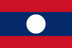
| Flag of Laos | |
Present-day Laos traces its historic and cultural identity to Lan Xang, which existed from the 13th century to the 18th century as one of the largest kingdoms in Southeast Asia. Because of its central geographical location in Southeast Asia, the kingdom became a hub for overland trade and became wealthy economically and culturally. After a period of internal conflict, Lan Xang broke into three separate kingdoms: Luang Phrabang, Vientiane and Champasak. In 1893, the three territories came under a French protectorate and were united to form what is now known as Laos. It briefly gained independence in 1945 after Japanese occupation but was re-colonised by France until it won autonomy in 1949. Laos became independent in 1953, with a constitutional monarchy under Sisavang Vong. A post-independence civil war began, which saw the communist resistance, supported by the Soviet Union, fight against the monarchy that later came under influence of military regimes supported by the United States. After the Vietnam War ended in 1975, the communist Pathet Lao came to power, ending the civil war. Laos was then dependent on military and economic aid from the Soviet Union until its dissolution in 1991.
Currency / Language
| ISO | Currency | Symbol | Significant figures |
|---|---|---|---|
| LAK | Lao kip | â‚ | 2 |
| ISO | Language |
|---|---|
| EN | English language |
| FR | French language |
| LO | Lao language |


