Usakos
Usakos (grab the heel, Okanduu ) is a town on the banks of river Khan, 140 kilometres north-east of Swakopmund in the Erongo Region of Namibia. It is located on the B2 (Trans-Kalahari Highway), the main road between the Walvis Bay and Johannesburg. The town has 3,000 inhabitants and owns 58 km2 of land.
Surrounded by mountains, Usakos is quite picturesque. Certain spots around the town show the longest uninterrupted horizon in the world. It is the closest town to the Spitzkoppe, often referred to as the "Matterhorn of Namibia".
The settlement was founded in the early 1900s as a workshop and watering station for locomotives. Herero chief Samuel Maharero sold the land to Europeans who resold it in 1903 to the Otavi Minen- und Eisenbahngesellschaft (Otavi Mining and Railway Company) (OMEG) which operated an industrial railway line from Swakopmund to Tsumeb. OMEG established a railway station and a repair shop which was used until the 1960s. When mining operations slowed down, Usakos' importance faded quickly. Today it is just a drive-through from the Namibian inland to the coast.
Historic buildings and structures in Usakos are the Roman Catholic church (erected 1905), the now dilapidated railway station building, and the old hotel.
Map - Usakos
Map
Country - Namibia
 |
 |
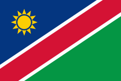
| Flag of Namibia | |
The driest country in sub-Saharan Africa, Namibia has been inhabited since pre-historic times by the San, Damara and Nama people. Around the 14th century, immigrating Bantu peoples arrived as part of the Bantu expansion. Since then, the Bantu groups, the largest being the Ovambo, have dominated the population of the country; since the late 19th century, they have constituted a majority. Today Namibia is one of the least densely populated countries in the world.
Currency / Language
| ISO | Currency | Symbol | Significant figures |
|---|---|---|---|
| NAD | Namibian dollar | $ | 2 |
| ZAR | South African rand | Rs | 2 |
| ISO | Language |
|---|---|
| AF | Afrikaans language |
| EN | English language |
| DE | German language |
| HZ | Herero language |


