Unity (Unity)
 |
In 2015, a presidential decree established a new system of 28 states, replacing the previously established 10. Unity state was replaced by the states of Ruweng, Northern Liech and Southern Liech. Unity State was re-established by a peace agreement signed on 22 February 2020 with smaller boundaries as the northern part of the former state became the Ruweng Administrative Area.
The capital of Unity state is Bentiu. Before an administrative reorganization in 1994, Unity was part of a much larger province of Upper Nile, and the state was sometimes called Western Upper Nile. The counties of Unity were:
* Guit County
* Koch County
* Leer County
* Mayiandit County
* Mayom County
* Panyijar County
* Rubkona County
Map - Unity (Unity)
Map


Country - South_Sudan
 |
 |
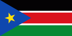
| Flag of South Sudan | |
South Sudan gained independence from Sudan on 9 July 2011, making it the most recent sovereign state or country with widespread recognition as of 2023. It includes the vast swamp region of the Sudd, formed by the White Nile and known locally as the Bahr al Jabal, meaning "Mountain River". Sudan was occupied by Egypt under the Muhammad Ali dynasty and was governed as an Anglo-Egyptian condominium until Sudanese independence in 1956. Following the First Sudanese Civil War, the Southern Sudan Autonomous Region was formed in 1972 and lasted until 1983. A second Sudanese civil war soon broke out in 1983 and ended in 2005 with the Comprehensive Peace Agreement. Later that year, southern autonomy was restored when an Autonomous Government of Southern Sudan was formed. South Sudan became an independent state on 9 July 2011, following 98.83% support for independence in a January 2011 referendum. It has suffered ethnic violence and endured a civil war characterized by rampant human rights abuses, including various ethnic massacres and killings of journalists by various parties to the conflict from December 2013 until February 2020, when competing combat leaders Salva Kiir Mayardit and Riek Machar struck a unity deal and formed a coalition government, paving the way for refugees to return home.
Currency / Language
| ISO | Currency | Symbol | Significant figures |
|---|---|---|---|
| SSP | South Sudanese pound | £ | 2 |
| ISO | Language |
|---|---|
| EN | English language |