Tribhuvan International Airport (Tribhuvan International Airport)
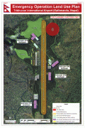
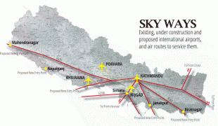
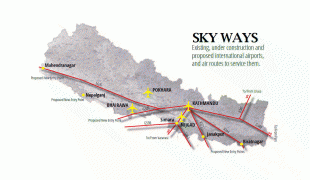
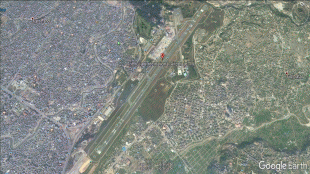
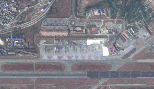
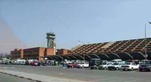
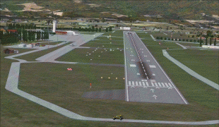
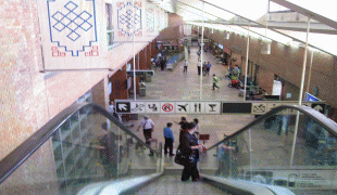
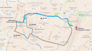
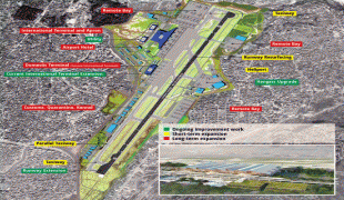
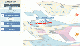
Tribhuvan International Airport (Nepali: त्रिभुवन अन्तर्राष्ट्रिय विमानस्थल) (, colloquially referred to as TIA) is an international airport located in Kathmandu, Bagmati, Nepal. It has a tabletop runway, a domestic terminal and an international terminal. As a main international airport, it connects Nepal to over 40 destinations in 17 countries.
The airport is a hub for two international airlines, the flag carrier Nepal Airlines and Himalaya Airlines, along with multiple domestic carriers. The airport is considered as a starting point for Mount Everest international tourists, with several daily flights to Lukla. Several airlines also offer Everest sightseeing flights out of Kathmandu.
Due to heavy traffic congestion, winter fog and the airport running out of its full capacity, the Government of Nepal promoted Gautam Buddha International Airport and Pokhara International Airport as alternative airports in case of necessary diversions.
The airport was originally named Gauchaur Airport, after the area of Kathmandu where it was situated. In Nepali, "Gauchaur" refers to a place where cows graze. The formal beginning of aviation in Nepal occurred in 1949, with the landing of a Beechcraft Bonanza carrying the Indian ambassador. However, there are claims that there is evidence that Simara Airport existed in some form as early as 1946 and would therefore be the oldest airport in Nepal – this is, however, disputed.
The very first flight into Gauchaur happened on 23 April 1949.
The first charter flight took place between Gauchaur and Calcutta, in a Himalayan Aviation Dakota on 20 February 1950.
On 20 February 1950, an Indian registered Dakota DC-3 commenced the first ever scheduled service, linking Kathmandu to Patna, Kolkata and Delhi.
In 1950, King Tribhuvan took refuge at the Indian embassy in an attempt to overthrow the Rana dynasty. Gyanendra Bir Bikram Shah, the four-year-old grandson of Tribhuvan was crowned the new king. On 10 November 1950, two Indian planes landed at Gauchaur Airport and carried the young king along with his grandfather to Delhi. After the Delhi Accord, the Rana regime ended and King Tribhuvan landed at Gauchaur Airport as the monarch on 18 February 1951, bringing the waves of democracy in Nepal.
In 1952, the first scheduled domestic flights commenced to Bhairahawa, Biratnagar, Pokhara and Simara.
On 15 June 1955, the airport was inaugurated by King Mahendra and renamed Tribhuvan Airport in memory of the king's father. The airport was again renamed to Tribhuvan International Airport in 1964.
| IATA Code | KTM | ICAO Code | VNKT | FAA Code | |
|---|---|---|---|---|---|
| Telephone | Fax | ||||
| Home page |
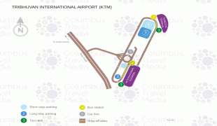
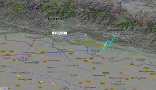
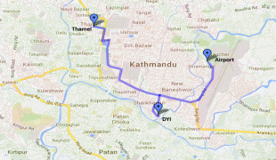
Map - Tribhuvan International Airport (Tribhuvan International Airport)
Map


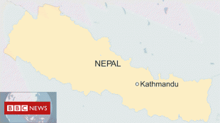
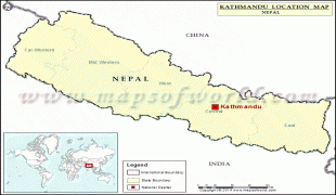
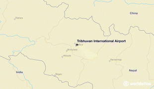
Country - Nepal
 |
 |
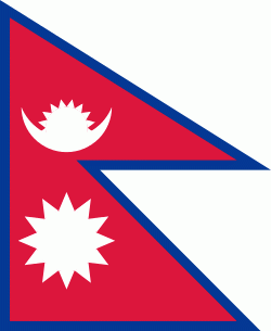
| Flag of Nepal | |
The name "Nepal" is first recorded in texts from the Vedic period of the Indian subcontinent, the era in ancient Nepal when Hinduism was founded, the predominant religion of the country. In the middle of the first millennium BC, Gautama Buddha, the founder of Buddhism, was born in Lumbini in southern Nepal. Parts of northern Nepal were intertwined with the culture of Tibet. The centrally located Kathmandu Valley is intertwined with the culture of Indo-Aryans, and was the seat of the prosperous Newar confederacy known as Nepal Mandala. The Himalayan branch of the ancient Silk Road was dominated by the valley's traders. The cosmopolitan region developed distinct traditional art and architecture. By the 18th century, the Gorkha Kingdom achieved the unification of Nepal. The Shah dynasty established the Kingdom of Nepal and later formed an alliance with the British Empire, under its Rana dynasty of premiers. The country was never colonised but served as a buffer state between Imperial China and British India. Parliamentary democracy was introduced in 1951 but was twice suspended by Nepalese monarchs, in 1960 and 2005. The Nepalese Civil War in the 1990s and early 2000s resulted in the establishment of a secular republic in 2008, ending the world's last Hindu monarchy.
Currency / Language
| ISO | Currency | Symbol | Significant figures |
|---|---|---|---|
| NPR | Nepalese rupee | ₨ | 2 |
| ISO | Language |
|---|---|
| EN | English language |
| NE | Nepali language |