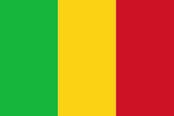
Mali, officially the Republic of Mali, is a landlocked country in West Africa. Mali is the eighth-largest country in Africa, with an area of over 1241238 km2. The population of Mali is million. 67% of its population was estimated to be under the age of 25 in 2017. Its capital and largest city is Bamako. The sovereign state of Mali consists of ten regions and its borders on the north reach deep into the middle of the Sahara Desert. The country's southern part is in the Sudanian savanna, where the majority of inhabitants live, and both the Niger and Senegal rivers pass through. The country's economy centres on agriculture and mining. One of Mali's most prominent natural resources is gold, and the country is the third largest producer of gold on the African continent. It also exports salt.
Present-day Mali was once part of three extremely powerful and wealthy West African empires that controlled trans-Saharan trade: the Ghana Empire (for which Ghana is named), the Mali Empire (for which Mali is named), and the Songhai Empire. At its peak in 1300, the Mali Empire was the wealthiest country in Africa, covering an area about twice the size of modern-day France and stretched to the west coast of the continent. Mali was also one of the wealthiest countries on earth, and its emperor at its zenith, Mansa Musa, is believed to be possibly the wealthiest individual in history. Besides being an economic powerhouse, medieval Mali was a centre of Islam, culture and knowledge, with Timbuktu becoming a renowned place of learning with its university, one of the oldest in the world still active. The expanding Songhai Empire absorbed the empire in 1468, followed by a Saadian army which defeated the Songhai in 1591. In the late 19th century, during the Scramble for Africa, France seized control of Mali, making it a part of French Sudan. French Sudan (then known as the Sudanese Republic) joined with Senegal in 1959, achieving independence in 1960 as the Mali Federation. Shortly thereafter, following Senegal's withdrawal from the federation, the Sudanese Republic declared itself the independent Republic of Mali. After a long period of one-party rule, a coup in 1991 led to the writing of a new constitution and the establishment of Mali as a democratic, multi-party state.


