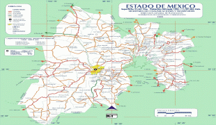
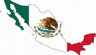
State of Mexico (Estado de México)
 |
 |
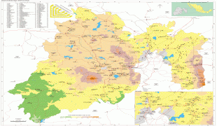
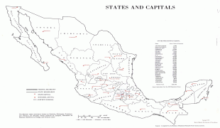
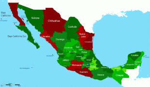
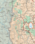
Located in South-Central Mexico, the state is divided into 125 municipalities. The state capital city is Toluca de Lerdo ("Toluca"), while its largest city is Ecatepec de Morelos ("Ecatepec"). The State of Mexico surrounds Mexico City on three sides and borders the states of Querétaro and Hidalgo to the north, Morelos and Guerrero to the south, Michoacán to the west, and Tlaxcala and Puebla to the east.
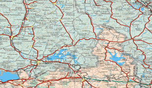
The territory that now comprises the State of Mexico once formed the core of the Pre-Hispanic Aztec Empire. During the Spanish colonial period, the region was incorporated into New Spain. After gaining independence in the 19th century, Mexico City was chosen as the capital of the new nation; its territory was separated out of the state. Years later, parts of the state were broken off to form the states of Hidalgo, Guerrero and Morelos. These territorial separations have left the state with the size and shape it has today, with the Toluca Valley to the west of Mexico City and a panhandle that extends around the north and east of this entity.
The demonym used to refer to people and things from the state is mexiquense, distinct from mexicano ('Mexican'), which describes the people or things from the country as a whole.
Mēxihco was originally the Nahuatl name for the Valley of Mexico where the cities of the Mexica (the proper name for the Aztec Triple Alliance) were located. As such, the district that became Mexico City was properly known as Mexico-Tenochtitlan in the years shortly before and after Spanish conquest. After the Spanish Conquest, the term México came to be used for Tenochtitlan/Mexico City and all the pre-conquest lands it controlled, including several other aforementioned Mexican states originally incorporated in the boundaries of the Mexico state.
There are two possible origins for the name “Mexico.” The first is that it derives from metztli (moon) and xictla (navel) to mean from the navel of the moon. This comes from the old Aztec idea that the craters on the moon form a rabbit figure with one crater imitating a navel. The other possible origin is that it is derived from “Mextictli”, an alternate name for the god Huitzilopochtli.
Anáhuac was the proper term for all territories dominated by the Aztec Empire, from Cem Anáhuac, "the entire earth" or "surrounded by waters" e.g. the waters of Lake Texcoco which were considered to be the center of the Aztec world, and as such was proposed as an early name for the entire nation of Mexico prior to independence, to distinguish it from the (preexisting) administrative division of New Spain that became the State of Mexico.
Map - State of Mexico (Estado de México)
Map


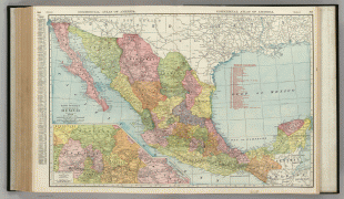
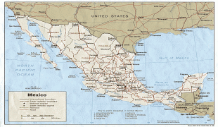

Country - Mexico


Currency / Language
| ISO | Currency | Symbol | Significant figures |
|---|---|---|---|
| MXV | Mexican Unidad de Inversion | 2 | |
| MXN | Mexican peso | $ | 2 |
| ISO | Language |
|---|---|
| ES | Spanish language |

