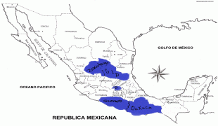
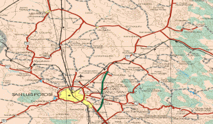
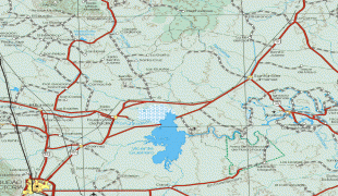
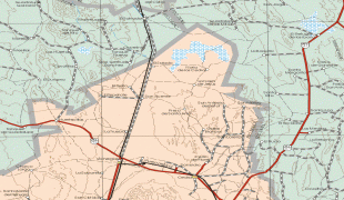
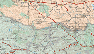
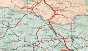
San Luis Potosí (Estado de San Luis Potosí)
 |
 |
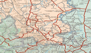
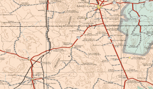
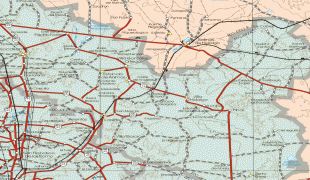
It is located in eastern and central Mexico and is bordered by seven other Mexican states: Nuevo León to the north; Tamaulipas to the north-east; Veracruz to the east; Hidalgo, Querétaro and Guanajuato to the south; and Zacatecas to north-west. In addition to the capital city, other major cities in the state include Ciudad Valles, Matehuala, Rioverde, and Tamazunchale.
In pre-Columbian times, the territory now occupied by the state of San Luis Potosí contained parts of the cultural areas of Mesoamerica and Aridoamerica. Its northern and western-central areas were inhabited by the Otomi and Chichimeca tribes. These indigenous groups were nomadic hunter-gatherers. Although many indigenous people died during Spanish colonization, Huasteco groups still live, along with Pame and Náhua peoples. In 1592, gold and silver deposits were discovered, which triggered the establishment of the state. Spanish miners established the first town known as “San Luis de Mezquitique”, modern location of the capital San Luis Potosí. This led to Juan de Oñate being appointed as the first mayor.
The State was given the name "San Luis Rey", King Saint Louis, in honor of Louis IX of France, and "Potosí" because the wealth of the state compared to the rich silver mines in Potosí, Bolivia. Settlers had hopes of rivaling the Bolivian mine wealth, but this was never truly accomplished. In the 17th and 18th centuries, Franciscans, Augustinians, and Jesuits arrived in the area and settled, then began to build churches and buildings, many of which are still standing and have been turned into museums and universities.
In mid-1821, after the Independence of Mexico, General Jose Antonio Echavarri intimidated and threatened the Mayor and the City Council to surrender the city of San Luis to the Army of the Three Guarantees of Agustín de Iturbide (Ejercito de las Tres Garantias de Iturbide), who at the time was emperor of Mexico. They submitted to his demand, as there was no way to resist, and thus proclamation of Independence of San Luis Potosí was declared. The first Constitution of San Luis Potosí was then written on October 16, 1826, and this was in effect until 1835 when Congress proclaimed it centralist. At this point, local legislatures disappeared and state governors were appointed by the central government. This situation lasted until the promulgation of the 1857 Constitution.
The state participation in the Mexican–American War in the years of 1846-1847 gave it the name "San Luis de la Patria", which translates into English, Saint Louis of the Homeland, for having contributed important leaders and ideas during the struggle with the United States. During the Reform War, state involvement was very prominent, and during the French Intervention in 1863, the city of San Luis Potosí became the capital of the country under the order of President Benito Juárez.
During the regime of Maximilian, San Luis became an important location. The city was held by the Imperialists until late 1866. In that year, the telegraph line was opened between San Luis Potosí and Mexico City, which opened up communication lines and helped begin the industrialization of the state.
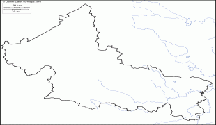
Map - San Luis Potosí (Estado de San Luis Potosí)
Map


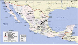


Country - Mexico


Currency / Language
| ISO | Currency | Symbol | Significant figures |
|---|---|---|---|
| MXV | Mexican Unidad de Inversion | 2 | |
| MXN | Mexican peso | $ | 2 |
| ISO | Language |
|---|---|
| ES | Spanish language |