Salavan Province (Salavan)
Salavan province covers an area of 16389 km2. The province borders Savannakhét province to the north, Vietnam to the east, Sekong province to the southeast, Champasak province to the south and Thailand to the west. The central part of the province is located on the Bolaven Plateau, which is a key agricultural area with Arabica coffee as the dominant cash crop. The western part of Salavan province is delimited by the Mekong River while the eastern part is delimited by the Lao-Vietnamese border.
Approximately 1,500 years ago, a Mon-Khmer group, the Khom established settlements in what is now Salavan province. It came to be ruled by the Champa after the Cham people migrated from South China to the territory. Various kingdoms united into the Lan Xang under Fa Ngum in 1353. Between 1779 and 1893, the province was a Thai colony. In the 20th century, it became a French Protectorate under the Franco-Siamese Treaty of October 3, 1893. The province had 8 districts and 715 villages after the liberation of 1975.
In the Indochina war, Salavan town was subject to extensive depredation when its control frequently shifted between the Royal Forces and the Pathet Lao. It was subsequently rebuilt with brick masonry and timber buildings, coexisting with the few old buildings which survived the war.
Map - Salavan Province (Salavan)
Map


Country - Laos
 |
 |
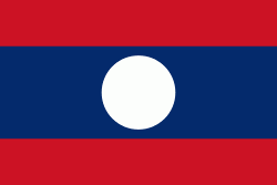
| Flag of Laos | |
Present-day Laos traces its historic and cultural identity to Lan Xang, which existed from the 13th century to the 18th century as one of the largest kingdoms in Southeast Asia. Because of its central geographical location in Southeast Asia, the kingdom became a hub for overland trade and became wealthy economically and culturally. After a period of internal conflict, Lan Xang broke into three separate kingdoms: Luang Phrabang, Vientiane and Champasak. In 1893, the three territories came under a French protectorate and were united to form what is now known as Laos. It briefly gained independence in 1945 after Japanese occupation but was re-colonised by France until it won autonomy in 1949. Laos became independent in 1953, with a constitutional monarchy under Sisavang Vong. A post-independence civil war began, which saw the communist resistance, supported by the Soviet Union, fight against the monarchy that later came under influence of military regimes supported by the United States. After the Vietnam War ended in 1975, the communist Pathet Lao came to power, ending the civil war. Laos was then dependent on military and economic aid from the Soviet Union until its dissolution in 1991.
Currency / Language
| ISO | Currency | Symbol | Significant figures |
|---|---|---|---|
| LAK | Lao kip | â‚ | 2 |
| ISO | Language |
|---|---|
| EN | English language |
| FR | French language |
| LO | Lao language |