Saint David Parish (Parish of Saint David)
* Area: 80 km² (31 mi²)
* Population: 6,700 (2000 estimates)
The following populated places are located within the parish of Saint David:
* Chateaubelair (13.28833°N, -61.24028°W)
* Richmond (13.3°N, -61.21667°W)
* Richmond Vale (13.29472°N, -61.23389°W)
* Rosehall (Rose Hall, 13.27028°N, -61.24028°W)
* Troumaka (13.28167°N, -61.25694°W)
* Wallibou (13.31667°N, -61.21667°W)
Map - Saint David Parish (Parish of Saint David)
Map


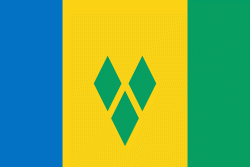
Country - Saint_Vincent_and_the_Grenadines
 |
 |
Its 369 km2 territory consists of the main island of Saint Vincent and, south of that, two-thirds of the northern part of the Grenadines, a chain of 32 smaller islands. Some of the Grenadines are inhabited—Bequia, Mustique, Union Island, Canouan, Petit Saint Vincent, Palm Island, Mayreau, Young Island—while others are not: Tobago Cays, Baliceaux, Battowia, Quatre, Petite Mustique, Savan and Petit Nevis. Most of Saint Vincent and the Grenadines lies within the Hurricane Alley.
Currency / Language
| ISO | Currency | Symbol | Significant figures |
|---|---|---|---|
| XCD | East Caribbean dollar | $ | 2 |
| ISO | Language |
|---|---|
| EN | English language |
| FR | French language |