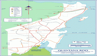
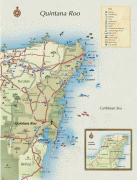
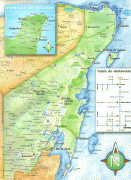
Quintana Roo (Estado de Quintana Roo)
 |
 |
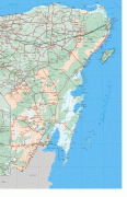
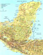
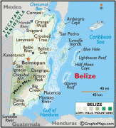
Quintana Roo is located on the eastern part of the Yucatán Peninsula and is bordered by the states of Campeche to the west and Yucatán to the northwest, and by the Orange Walk and Corozal districts of Belize, along with an offshore borderline with Belize District to the south. As Mexico's easternmost state, Quintana Roo has a coastline to the east with the Caribbean Sea and to the north with the Gulf of Mexico. The state previously covered 44705 km2 and shared a small border with Guatemala in the southwest of the state. However, in 2013, Mexico's Supreme Court of Justice of the Nation resolved the boundary dispute between Quintana Roo, Campeche, and Yucatán stemming from the creation of the Calakmul municipality by Campeche in 1997, siding with Campeche and thereby benefiting Yucatán.
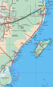
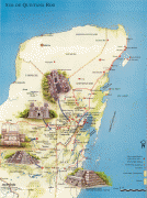
Quintana Roo is the home of the city of Cancún, the islands of Cozumel and Isla Mujeres, and the towns of Bacalar, Playa del Carmen and Akumal, as well as the ancient Maya ruins of Chacchoben, Cobá, Kohunlich, Muyil, Tulum, Xel-Há, and Xcaret. The Sian Ka'an biosphere reserve is also located in the state. The statewide population is expanding at a rapid rate due to the construction of hotels and the demand for workers. Many migrants come from Yucatán, Campeche, Tabasco, and Veracruz. The state is frequently hit by severe hurricanes due to its exposed location, the most recent and severe being Hurricane Dean in 2007, which made landfall with sustained winds of 280 km/h, with gusts up to 320 km/h.
The area that makes up modern Quintana Roo was long part of Yucatán, sharing its history. With the Caste War of Yucatán, which started in the 1840s, all non-natives were driven from the region. The independent Maya nation of Chan Santa Cruz was based on what is now the town of Felipe Carrillo Puerto. For decades it maintained considerable independence, having separate trade and treaty relationships with British Honduras, now Belize.
Quintana Roo was made a territory of Mexico by decree of President Porfirio Díaz on November 24, 1902. It was named after an early patriot of the Mexican Republic, Andrés Quintana Roo. The Mexican army succeeded in defeating most of the Maya population of the region during the 1910s. In 1913 the area was again declared to be legally part of the state of Yucatán, but was again declared a separate territory in 1915. The territory of Quintana Roo was granted statehood within the United Mexican States on October 8, 1974.
In the last quarter of the 20th century and continuing into the 21st, Quintana Roo developed rapidly, with tourism being a driving force, notably with the development of Cancún.
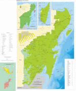
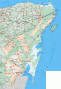
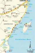
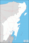
Map - Quintana Roo (Estado de Quintana Roo)
Map


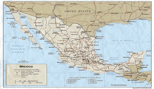

Country - Mexico


Currency / Language
| ISO | Currency | Symbol | Significant figures |
|---|---|---|---|
| MXV | Mexican Unidad de Inversion | 2 | |
| MXN | Mexican peso | $ | 2 |
| ISO | Language |
|---|---|
| ES | Spanish language |