Perlis
 |
 |
The capital of Perlis is Kangar, and the royal capital is Arau. Another important town is Padang Besar, at the Malaysia–Thailand border and Kuala Perlis, the ferry town to Langkawi. The main port and ferry terminal is at the small village of Kuala Perlis, linking mostly to Langkawi Island. Another important lately developed area is Pauh Putra within subdistrict of Kurong Anai which houses the main campus of Malaysia University of Perlis and Politeknik Tuanku Syed Sirajuddin. Perlis has a famous snake farm and research centre at Sungai Batu Pahat. Perlis State Park and Gua Kelam are among the popular tourist attractions.
It is unclear how the name Perlis came about. There are several hypotheses:
* According to a Malaysian historian, Mohd Yusuf bin Adil, the name comes from the Thai phrase "Phrao Loi" (Southern Thai: พร้าวลอย) which means kelapa hanyut (coconut washed ashore) since there were many coconuts found on the shores of Kuala Perlis. The phrase has been shortened by locals until it sounded like "pereleh" or Perlis.
* It has also been suggested Perlis may be a shortened form of a Malay word "peroleh" (obtain) as the state was a "gift" from Kedah, since it was a part of Kedah before becoming a state on its own.
* According to Negeri Perlis Indera Kayangan: Sejarah Pembentukan Sebuah Negeri Berdaulat by Ahmad Ismail, the name comes from a tree of the same name, which may have gone extinct.
* Some researches suggests the name is derived from a Northern Malay dialect word "perelus" which roughly translates as "foot falling into a crack", since Perlis is said to have a wide land filled with mud, and the people's feet may sink into the mud.
* Additional suggestions include being named after someone, or derived from the French word "perlite" which means "rock" due to a huge rock near Sungei Perlis.
The honorific Indera Kayangan was given by Tuanku Raja Syed Hussin Jamalullail (who ruled Perlis from 1843 to 1873) after the royal town of Indera Kayangan II (1797 until 1813) he was raised in now located in Kampung Langgar, Kayang within the Kuala Perlis area. However, this epithet became less popular under the recommendation of Tuanku Syed Sirajuddin Putra Jamalullail in 2015, in which according to him is inline with the official singular name given in the state constitution his father signed without any long epithets in general "which is related to deities, or any 'Darul'..."".
Map - Perlis
Map
Country - Malaysia
 |
 |
| Flag of Malaysia | |
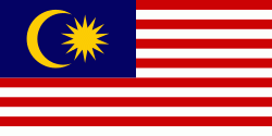
Malaysia has its origins in the Malay kingdoms, which, from the 18th century on, became subject to the British Empire, along with the British Straits Settlements protectorate. Peninsular Malaysia was unified as the Malayan Union in 1946. Malaya was restructured as the Federation of Malaya in 1948 and achieved independence on 31 August 1957. The independent Malaya united with the then British crown colonies of North Borneo, Sarawak, and Singapore on 16 September 1963 to become Malaysia. In August 1965, Singapore was expelled from the federation and became a separate independent country.
Currency / Language
| ISO | Currency | Symbol | Significant figures |
|---|---|---|---|
| MYR | Malaysian ringgit | RM | 2 |
| ISO | Language |
|---|---|
| ZH | Chinese language |
| EN | English language |
| MS | Malay language |
| ML | Malayalam language |
| PA | Panjabi language |
| TA | Tamil language |
| TE | Telugu language |
| TH | Thai language |


