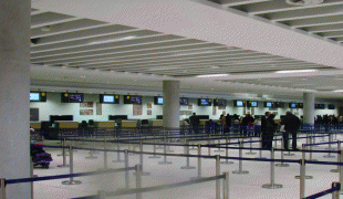
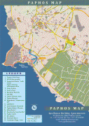
Paphos International Airport (Paphos International Airport)
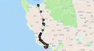
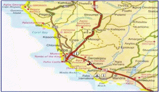
Paphos International Airport (Διεθνής Αερολιμένας Πάφου; Baf Uluslararası Havalimanı) is a joint civil-military public airport located 6.5 km southeast of the city of Paphos, Cyprus. It is the country's second largest airport, after Larnaca International Airport. Paphos Airport is commonly used by tourists on vacation in western Cyprus, providing access to popular resorts such as Coral Bay, Limassol (about 50 km south-east) and Paphos itself.
The airport first opened in 1982. In May 2006, Hermes Airports Limited took over the construction, development and operation of both Larnaca and Paphos airports for a period of 25 years. According to the airport operator, Paphos Airport served 1,744,011 passengers in 2007. A new terminal opened at Paphos in November 2008.
On 10 January 2012, Ryanair announced they were to open their 50th base in Paphos. In April 2012, they placed 2 aircraft in Paphos with 15 new routes, offering over 80 flights a week. Ryanair claim the reason they opened the base in Paphos was due to reduced landing charges offered by Hermes' incentive scheme, as well as the fact that they can easily operate within their standards (e.g. their typical 25 minutes turnaround time).
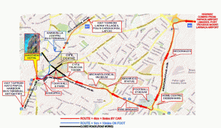
A new four-lane road is being planned to link the airport and Paphos so passengers and staff can avoid using the B6 Main road and the E603 secondary road which are often heavily congested.
The airport first opened in 1982. In May 2006, Hermes Airports Limited took over the construction, development and operation of both Larnaca and Paphos airports for a period of 25 years. According to the airport operator, Paphos Airport served 1,744,011 passengers in 2007. A new terminal opened at Paphos in November 2008.
On 10 January 2012, Ryanair announced they were to open their 50th base in Paphos. In April 2012, they placed 2 aircraft in Paphos with 15 new routes, offering over 80 flights a week. Ryanair claim the reason they opened the base in Paphos was due to reduced landing charges offered by Hermes' incentive scheme, as well as the fact that they can easily operate within their standards (e.g. their typical 25 minutes turnaround time).
A new four-lane road is being planned to link the airport and Paphos so passengers and staff can avoid using the B6 Main road and the E603 secondary road which are often heavily congested.
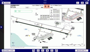
| IATA Code | PFO | ICAO Code | LCPH | FAA Code | |
|---|---|---|---|---|---|
| Telephone | Fax | ||||
| Home page | Hyperlink |
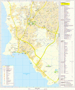
Map - Paphos International Airport (Paphos International Airport)
Map


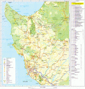
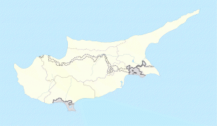
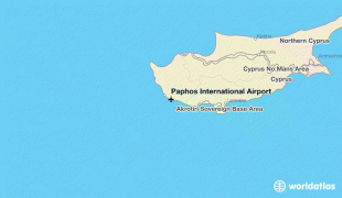
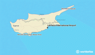
Country - Cyprus
 |
 |
| Flag of Cyprus | |
The earliest known human activity on the island dates to around the 10th millennium BC. Archaeological remains include the well-preserved ruins from the Hellenistic period such as Salamis and Kourion, and Cyprus is home to some of the oldest water wells in the world. Cyprus was settled by Mycenaean Greeks in two waves in the 2nd millennium BC. As a strategic location in the Eastern Mediterranean, it was subsequently occupied by several major powers, including the empires of the Assyrians, Egyptians and Persians, from whom the island was seized in 333 BC by Alexander the Great. Subsequent rule by Ptolemaic Egypt, the Classical and Eastern Roman Empire, Arab caliphates for a short period, the French Lusignan dynasty and the Venetians was followed by over three centuries of Ottoman rule between 1571 and 1878 (de jure until 1914).
Currency / Language
| ISO | Currency | Symbol | Significant figures |
|---|---|---|---|
| EUR | Euro | € | 2 |
| ISO | Language |
|---|---|
| EN | English language |
| EL | Greek language |
| TR | Turkish language |