Ouham
Ouham is one of the 16 prefectures of the Central African Republic. Its capital is Bossangoa.
The prefecture is in the north-west of the Central African Republic. In the north it has a border with Chad. In the south is the prefecture Ombella-Mpoko, in the west the prefecture Ouham-Pendé and in the east the prefectures Nana-Grébizi and Kémo.
The prefecture is in the north-west of the Central African Republic. In the north it has a border with Chad. In the south is the prefecture Ombella-Mpoko, in the west the prefecture Ouham-Pendé and in the east the prefectures Nana-Grébizi and Kémo.
Map - Ouham
Map


Country - Central_African_Republic
 |
 |
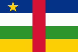
| Flag of the Central African Republic | |
The Central African Republic covers a land area of about 620000 km2. , it had an estimated population of around million. , the Central African Republic is the scene of a civil war, which is ongoing since 2012.
Currency / Language
| ISO | Currency | Symbol | Significant figures |
|---|---|---|---|
| XAF | Central African CFA franc | Fr | 0 |
| ISO | Language |
|---|---|
| FR | French language |
| KG | Kongo language |
| LN | Lingala language |
| SG | Sango language |