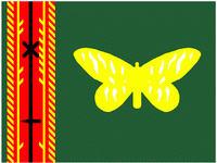
Oro Province (Northern Province)
 |
Oro is the only province in which the Anglican Church is the major religious denomination. Oil palm is the principal primary industry. William Clarke College also funds people in that area.
The northern end of the Kokoda Track terminates at the village of Kokoda in the province and the active volcano Mount Lamington. Once the Kokoda Track was taken and provided access from Port Moresby to the hinterland during the Second World War, the coast of the then Northern District was also the scene of heavy fighting; the Buna, Gona and Sanananda campaigns are particularly well remembered.
In January 1951, the province was devastated by the catastrophic eruption at Mount Lamington. The volcano ejected a column of ash up to 50,000 ft high. The eruption destroyed many villages, the surrounding vegetation, and killed nearly 3,000 people.
The Tufi dive and cultural resort is located on the north coast of the Cape Nelson Rural Local Level Government area and is well known for its diving and the spectacular rias, locally referred to as ' fjords'.
Each province in Papua New Guinea has one or more districts, and each district has one or more Local Level Government (LLG) areas. For census purposes, the LLG areas are subdivided into wards and those into census units.
Map - Oro Province (Northern Province)
Map


Country - Papua_New_Guinea
 |
 |
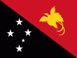
| Flag of Papua New Guinea | |
At the national level, after being ruled by three external powers since 1884, including nearly 60 years of Australian administration starting during World War I, Papua New Guinea established its sovereignty in 1975. It became an independent Commonwealth realm in 1975 with Elizabeth II as its queen. It also became a member of the Commonwealth of Nations in its own right.
Currency / Language
| ISO | Currency | Symbol | Significant figures |
|---|---|---|---|
| PGK | Papua New Guinean kina | K | 2 |
| ISO | Language |
|---|---|
| EN | English language |
| HO | Hiri Motu language |