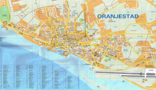
Oranjestad (Oranjestad)
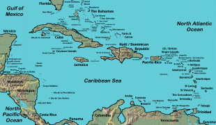
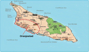
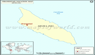
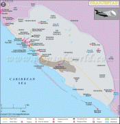
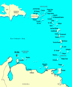
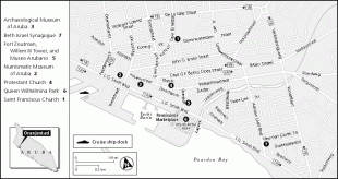
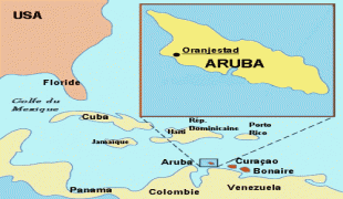
Oranjestad ( ; literally "Orange City") is the capital and largest city of Aruba, a constituent country of the Kingdom of the Netherlands. It is located on the southern coast near the western end of the island country. In the local language, Papiamento, Oranjestad is often referred to as "Playa". In 2010, the population of the capital was 28,294.
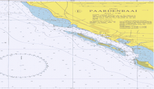
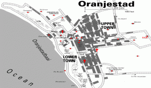
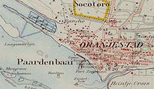
The town was built around Fort Zoutman shortly after it was built in 1796. Initially, the town had no official name, being known only as the town on the Bay of Horses (Paardenbaai in Dutch), a place from which horses were raised and exported to neighbouring Curaçao and Jamaica. In the early 19th century, Oranjestad was like a village, because Aruba had no large plantations or international traders. The total population of the island in 1816 was estimated at 1,732 most of whom were farmers. Fort Zoutman was the main building around which 200 small houses had been erected. The town had two churches: one Catholic and one Protestant. Nearby was the fishing village of Rancho.
Oranjestad became the capital city of the island in 1824. It was named after the first King William I of the Netherlands. During that period interest in Aruba increased due to the discovery of alluvial gold deposits. The oil industry discovered Aruba in 1924. The establishment of an oil refinery by Lago Oil and Transport Company not only resulted in a population increase, but a significant increase in the prosperity of the island. From the 1960s onwards, tourism became more important and has resulted in the creation of a large hotel zone. Administratively, the city has been split in two districts: East and West. Oranjestad, Noord and Santa Cruz have merged into one near continuous urban area covering the north of the island.
Map - Oranjestad (Oranjestad)
Map


Country - Aruba
 |
 |
Aruba is one of the four countries that form the Kingdom of the Netherlands, along with the Netherlands, Curaçao, and Sint Maarten; the citizens of these countries are all Dutch nationals. Aruba has no administrative subdivisions, but, for census purposes, is divided into eight regions. Its capital is Oranjestad. Unlike much of the Caribbean region, Aruba has a dry climate and an arid, cactus-strewn landscape. The relatively warm and sunny weather, and the climate allow for related tourism activities all year round. Its area is 179 km2 and it is quite densely populated, with 108,166 inhabitants per the 2020 census.
Currency / Language
| ISO | Currency | Symbol | Significant figures |
|---|---|---|---|
| AWG | Aruban florin | Æ’ | 2 |
| ISO | Language |
|---|---|
| NL | Dutch language |
| EN | English language |
| ES | Spanish language |