Obo
Obo is the capital of Haut-Mbomou, one of the 14 prefectures of the Central African Republic. It is close to the African Pole of Inaccessibility.
Poste Airport is located near the town.
Obo was named after the local Zande chief Orbo, with the spelling changed slightly in later years. Orbo ruled the territory between the Mbokou and Kamou rivers. However, a conflict emerged when nearby Chief Gougbéré annexed much of Orbo's territory on the pretext that the inhabitants were from the same ethnic group as him. Orbo petitioned Sultan Zémio, who was his first cousin once removed, to help, but the sultan did not intervene. Orbo then asked French colonial captain Maurice Martin to mediate in 1910. Martin sided with Orbo's land claims, but said that any new settlements should be allowed to remain.
French military general Jean Baptiste Marchand passed through the area on his journey to find the source of the Nile. When he failed to find access to the river, the settlement became a cul-de-sac and he moved on in a different direction.
The Africa Inland Mission established a presence in the town in 1925, run by the Linquist family. It was one of a number of evangelical missions among the Zande areas of Ubangi-Shari and the Belgian Congo.
On the night of 5 March 2008, Obo witnessed the first LRA's attack. The group attacked the AIM neighborhood and abducted 73 residents.
Map - Obo
Map
Country - Central_African_Republic
 |
 |
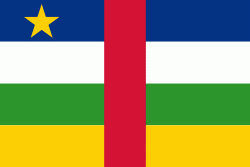
| Flag of the Central African Republic | |
The Central African Republic covers a land area of about 620000 km2. , it had an estimated population of around million. , the Central African Republic is the scene of a civil war, which is ongoing since 2012.
Currency / Language
| ISO | Currency | Symbol | Significant figures |
|---|---|---|---|
| XAF | Central African CFA franc | Fr | 0 |
| ISO | Language |
|---|---|
| FR | French language |
| KG | Kongo language |
| LN | Lingala language |
| SG | Sango language |


