Nyeri
Nyeri is a town situated in the Central Highlands of Kenya. It is the county headquarters of Nyeri County. The town was the central administrative headquarters of the country's former Central Province. Following the dissolution of the former provinces by Kenya's new constitution on 26 August 2010, the city is situated about 150 km north of Kenya's capital Nairobi, in the country's densely populated and fertile Central Highlands, lying between the eastern base of the Aberdare (Nyandarua) Range, which forms part of the eastern end of the Great Rift Valley, and the western slopes of Mount Kenya.
The city population, according to the 2019 Kenya Population and Housing Census, was estimated at 140,338. However, the number is rapidly growing. There is, however, a significant population of primarily Government and corporate workers who ordinarily reside in Nyeri but who, during the census, choose to be counted in their areas of origin or the areas where their families are residents. The town has a relatively low cost of living in comparison to Nairobi and other major urban centres in Kenya. Located in Kenya's fertile highlands, food and water are plentiful and relatively cheap.
Nyeri hosts the tomb of Robert Baden Powell, the founder of the Scout movement. It is also the home town of the late Nobel laureate Wangari Maathai. The town is also the home of the Dedan Kimathi University of Technology (DeKUT), founded by the local community in the early 1970s as an institute of technology, and converted into a fully fledged university in 2012.
Towards the end of 1902, as the British were establishing their colonial presence, Richard Meinertzhagen marched a strong military column meeting spirited resistance from the native Kikuyu warriors led by Wangombe Wa Ihura. The Kikuyu were eventually defeated. After Meinertzhagen's victory, a decision was reached to site a British post close to a little hill on the slopes of Mt. Kenya. The Kikuyu called the hill Kia-Nyiri while their Maasai neighbours called the hill Na-aier. The post took its name from the little hill. On 18 December 1902, Nyeri was founded.
Shortly after the establishment of the post, a trickle of European settlers and missionaries and Indian merchants began to migrate into Nyeri and the surrounding areas. The city soon burgeoned into a trading centre for white settler farmers who produced cattle, wheat and coffee. The city became particularly associated with the Happy Valley set in the first half of the twentieth century. The Nyeri Golf Club, The White Rhino Hotel, Outspan Hotel, and the Aberdare Country Club at nearby Mweiga township are relics of those colonial days.
Map - Nyeri
Map
Country - Kenya
 |
 |
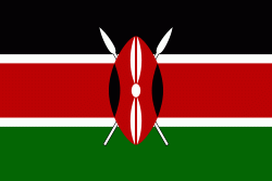
| Flag of Kenya | |
Kenya's earliest inhabitants were hunter-gatherers, like the present-day Hadza people. According to archaeological dating of associated artifacts and skeletal material, Cushitic speakers first settled in Kenya's lowlands between 3,200 and 1,300 BC, a phase known as the Lowland Savanna Pastoral Neolithic. Nilotic-speaking pastoralists (ancestral to Kenya's Nilotic speakers) began migrating from present-day South Sudan into Kenya around 500 BC. Bantu people settled at the coast and the interior between 250 BC and 500 AD. European contact began in 1500 AD with the Portuguese Empire, and effective colonisation of Kenya began in the 19th century during the European exploration of the interior. Modern-day Kenya emerged from a protectorate established by the British Empire in 1895 and the subsequent Kenya Colony, which began in 1920. Numerous disputes between the UK and the colony led to the Mau Mau revolution, which began in 1952, and the declaration of independence in 1963. After independence, Kenya remained a member of the Commonwealth of Nations. The current constitution was adopted in 2010 and replaced the 1963 independence constitution.
Currency / Language
| ISO | Currency | Symbol | Significant figures |
|---|---|---|---|
| KES | Kenyan shilling | Sh | 2 |
| ISO | Language |
|---|---|
| EN | English language |
| SW | Swahili language |


