Northwest Region (North-West Region)
In 1919, the Northwest Region became solely administered by the United Kingdom. In 1961, the region joined the Cameroon. Separatists from the Ambazonian administration regard both the Nord-Ouest (Northwest) and Sud-Ouest (Southwest) regions as being constituent components of their envisaged breakaway state.
The Northwest Region (known before 2008 as the Northwest Province) is the third most populated province in Cameroon. It has one major metropolitan city, Bamenda, with several other smaller towns such as Wum, Kumbo, Mbengwi, Ndop, Nkambé, Batibo, Bambui and Oshie. The province saw an increase in its population from approximately 1.2 million in 1987 to 1.8 million in 2010. The population density of 99.12 people per square kilometer is higher than the national average of 22.6. The provincial urban growth rate is 7.95%, higher than the national average of 5.6%, while the rural growth rate, at 1.16%, is equal to the national rate. In 2001, according to the Statistical Provincial Services of the North-West Province, the population of the province is young, with over 62% of its residents being less than 20 years old. Therefore, the dependency rate in the province is high, particularly in the rural areas.
Like other regions in Cameroon, the Northwest Region is made up of administrative divisions. The province was created in 1972 with five divisions or departments: Bui, Donga-Mantung, Menchum, Mezam, and Momo. Today, it has seven divisions, the additions being Boyo, which was carved out of the Menchum division, and Ngo-Ketunjia or Ngoketunjia, split off from the Mezam division. Each division is further subdivided, with thirty-one total subdivisions in the Northwest Province. The basic unit of local government is the council, and there are thirty-two councils in the region.
Map - Northwest Region (North-West Region)
Map
Country - Cameroon
 |
 |
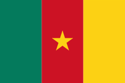
| Flag of Cameroon | |
Early inhabitants of the territory included the Sao civilisation around Lake Chad, and the Baka hunter-gatherers in the southeastern rainforest. Portuguese explorers reached the coast in the 15th century and named the area Rio dos Camarões (Shrimp River), which became Cameroon in English. Fulani soldiers founded the Adamawa Emirate in the north in the 19th century, and various ethnic groups of the west and northwest established powerful chiefdoms and fondoms. Cameroon became a German colony in 1884 known as Kamerun. After World War I, it was divided between France and the United Kingdom as League of Nations mandates. The Union des Populations du Cameroun (UPC) political party advocated independence, but was outlawed by France in the 1950s, leading to the national liberation insurgency fought between French and UPC militant forces until early 1971. In 1960, the French-administered part of Cameroon became independent, as the Republic of Cameroun, under President Ahmadou Ahidjo. The southern part of British Cameroons federated with it in 1961 to form the Federal Republic of Cameroon. The federation was abandoned in 1972. The country was renamed the United Republic of Cameroon in 1972 and back to the Republic of Cameroon in 1984 by a presidential decree by president Paul Biya. Paul Biya, the incumbent president, has led the country since 1982 following Ahidjo's resignation; he previously held office as prime minister from 1975 on. Cameroon is governed as a Unitary Presidential Republic.
Currency / Language
| ISO | Currency | Symbol | Significant figures |
|---|---|---|---|
| XAF | Central African CFA franc | Fr | 0 |
| ISO | Language |
|---|---|
| EN | English language |
| FR | French language |


