Northern Cape (Northern Cape)
 |
The Namaqualand region in the west is famous for its Namaqualand daisies. The southern towns of De Aar and Colesberg found within the Great Karoo are major transport nodes between Johannesburg, Cape Town and Port Elizabeth. Kuruman can be found in the north-east and is known as a mission station. It is also well known for its artesian spring and Eye of Kuruman. The Orange River flows through the province of Northern Cape, forming the borders with the Free State in the southeast and with Namibia to the northwest. The river is also used to irrigate the many vineyards in the arid region near Upington.
Native speakers of Afrikaans comprise a higher percentage of the population in the Northern Cape than in any other province. The Northern Cape's four official languages are Afrikaans, Tswana, Xhosa, and English. Minorities speak the other official languages of South Africa and a few people speak indigenous languages such as Nama and Khwe.
The provincial motto, Sa ǁa ǃaĩsi 'uĩsi ("We go to a better life"), is in the Nǀu language of the Nǁnǂe (ǂKhomani) people. It was given in 1997 by one of the language's last speakers, Ms. Elsie Vaalbooi of Rietfontein, who has since died. It was South Africa's first officially registered motto in a Khoisan language. Subsequently, South Africa's national motto, ǃKe e ǀxarra ǁke, was derived from the extinct Northern Cape ǀXam language.
The Northern Cape was one of three provinces made out of the Cape Province in 1994, the others being Western Cape to the south and Eastern Cape to the southeast. Politically, it had been dominated since 1994 by the African National Congress (ANC). Ethnic issues are important in the politics of the Northern Cape. For example, it is the site of the Orania settlement, whose leaders have called for a Volkstaat for the Afrikaner people in the province.
The Northern Cape is also the home of over 1,000 San who emigrated from Namibia following the independence of the country; they had served as trackers and scouts for the South African Defence Force during the South African Border War, and feared reprisals from their former foes. They were awarded a settlement in Platfontein in 1999 by the Mandela government.
The precolonial history of the Northern Cape is reflected in a rich, mainly Stone Age, archaeological heritage. Cave sites include Wonderwerk Cave near Kuruman, which has a uniquely long sequence stretching from the turn of the twentieth century at the surface to more than 1 million (and possibly nearly 2 million) years in its basal layer (where stone tools, occurring in very low density, may be Oldowan). Many sites across the province, mostly in open air locales or in sediments alongside rivers or pans, document Earlier, Middle and Later Stone Age habitation. From Later Stone Age times, mainly, there is a wealth of rock art sites – most of which are in the form of rock engravings such as at Wildebeest Kuil and many sites in the area known as ǀXam -ka !kau, in the Karoo. They occur on hilltops, slopes, rock outcrops and occasionally (as in the case of Driekops Eiland near Kimberley), in a river bed. In the north eastern part of the province there are sites attributable to the Iron Age such as Dithakong. Environmental factors have meant that the spread of Iron Age farming westwards (from the 17th century – but dating from the early first millennium AD in the eastern part of South Africa) was constrained mainly to the area east of the Langeberg Mountains, but with evidence of influence as far as the Upington area in the eighteenth century. From that period the archaeological record also reflects the development of a complex colonial frontier when precolonial social formations were considerably disrupted and there is an increasing 'fabric heavy' imprint of built structures, ash-heaps, and so on. The copper mines of Namaqualand and the diamond rush to the Kimberley area resulted in industrial archaeological landscapes in those areas which herald the modern era in South African history.
Map - Northern Cape (Northern Cape)
Map


Country - South_Africa
 |
 |
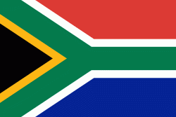
| Flag of South Africa | |
About 80% of the population are Black South Africans. The remaining population consists of Africa's largest communities of European (White South Africans), Asian (Indian South Africans and Chinese South Africans), and multiracial (Coloured South Africans) ancestry. South Africa is a multiethnic society encompassing a wide variety of cultures, languages, and religions. Its pluralistic makeup is reflected in the constitution's recognition of 11 official languages, the fourth-highest number in the world. According to the 2011 census, the two most spoken first languages are Zulu (22.7%) and Xhosa (16.0%). The two next ones are of European origin: Afrikaans (13.5%) developed from Dutch and serves as the first language of most Coloured and White South Africans; English (9.6%) reflects the legacy of British colonialism and is commonly used in public and commercial life.
Currency / Language
| ISO | Currency | Symbol | Significant figures |
|---|---|---|---|
| ZAR | South African rand | Rs | 2 |
| ISO | Language |
|---|---|
| AF | Afrikaans language |
| EN | English language |
| ST | Sotho language |
| SS | Swati language |
| TS | Tsonga language |
| TN | Tswana language |
| VE | Venda language |
| XH | Xhosa language |
| ZU | Zulu language |

