North Kivu (Province du Nord-Kivu)
North Kivu borders the provinces of Ituri to the north, Tshopo to the northwest, Maniema to the southwest, and South Kivu to the south. To the east, it borders the countries of Uganda and Rwanda.
The province consists of three cities—Goma, Butembo and Beni—and six territories—Beni, Lubero, Masisi, Rutshuru, Nyiragongo and Walikale. It is home to the Virunga National Park, a World Heritage Site containing the endangered mountain gorillas.
The region is politically unstable and since 1998 has been one of the flashpoints of the military conflicts in the region.
North Kivu was the site of an Ebola epidemic, which was compounded by political instability in the region.
The frontiers of the Congo Free State were defined by the Neutrality Act during the 1885 Berlin Conference, in which the European powers staked out their territorial claims in Africa. The Congo Free State's northeastern boundary was defined in 1885 as "a straight line coming from the northern end of Lake Tanganyika and ending at a point located on the 30th east meridian and at 1° 20' south latitude; further north, the border is formed by the 30th meridian east." On this basis, all of Lake Kivu and both banks of the Ruzizi River were in the Free State.
In June 1909, John Methuen Coote started the Kivu frontier incident when he travelled southwest from the British Uganda Protectorate and established fortified camps at Burungu and Rubona on Lake Kivu. British troops under Coote withdrew from the Rubona post on 29 June 1909, and the Belgians occupied the post. After a series of incidents, the boundaries of the Congo, Uganda and Rwanda were settled in May 1910, with the eastern part of Kivu assigned to Uganda and the German colony of Rwanda.
Kivu District was created by an arrêté royal of 28 March 1912, which divided the Congo into 22 districts. By 1954, Kivu District had been split into Sud-Kivu District and Nord-Kivu District.
The region was the scene of much fighting during the Second Congo War (1998–2003) and the Kivu conflict (2004–present).
On August 19, 2003, DRC government decree 019/2003 offered Laurent Nkunda the rank of Brigadier General and command of the new Congo Government's FARDC Eighth Military Region, covering North Kivu. He declined. On May 26, 2004, General Obed Wibasira (RCD-Goma) was named to the position. But Wibasira was suspected of complicity with the soldiers in Goma who had triggered a mutiny in Bukavu in February 2004, and on January 23, 2005, he was switched with Gabriel Amisi Kumba, at the time commander of the Fifth Military Region in Kasaï-Oriental. Kumba was named as a Brigadier General when taking up the post. General Louis Ngizo, a former commander of the Rally for Congolese Democracy, was appointed a commander in November 2006. But he had little influence compared to powerful military figures from Kinshasa, U.S. diplomats said in comments released via WikiLeaks. Brigadier General Vainqueur Mayala was transferred from command of the Ituri operational zone, promoted to Major General, and appointed military region commander in May 2007. Ngizo left Goma on May 13, 2007, his next posting not being known at the time. During late 2008, the FARDC maintained its dismal record in combat against Nkunda's CNDP faction, losing the Rumangabo military camp to the rebels.
Map - North Kivu (Province du Nord-Kivu)
Map
Country - Democratic_Republic_of_the_Congo
 |
 |
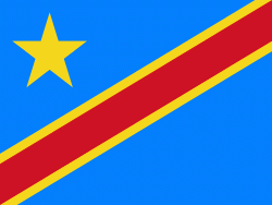
| Flag of the Democratic Republic of the Congo | |
Centered on the Congo Basin, the territory of the DRC was first inhabited by Central African foragers around 90,000 years ago and was reached by the Bantu expansion about 3,000 years ago. In the west, the Kingdom of Kongo ruled around the mouth of the Congo River from the 14th to 19th centuries. In the northeast, center and east, the kingdoms of Azande, Luba, and Lunda ruled from the 16th and 17th centuries to the 19th century. King Leopold II of Belgium formally acquired rights to the Congo territory in 1885 and declared the land his private property, naming it the Congo Free State. From 1885 to 1908, his colonial military forced the local population to produce rubber and committed widespread atrocities. In 1908, Leopold ceded the territory, which thus became a Belgian colony.
Currency / Language
| ISO | Currency | Symbol | Significant figures |
|---|---|---|---|
| CDF | Congolese franc | Fr | 2 |
| ISO | Language |
|---|---|
| FR | French language |
| KG | Kongo language |
| LN | Lingala language |


