Map - North Andros (North Andros District)

North Andros (North Andros District)
North Andros is one of the 31 districts of the Bahamas. It is also the largest district (in area) in the country. It has some of the largest settlements on Andros Island and many churches as well. The population (2010 Census) is 3,898.

There are a number of church denominations represented within Andros. In North Andros, the Anglican Episcopal Church has a presence through St. Margaret's Parish. This parish consist of two churches: St. Margaret's, located in the settlement of Nicholl's Town; and St. Mary Magdalene, located in the settlement of Mastic Point. There are two denominations of Methodist Churches. (MCCA) Wesley Methodist church is located in Mastic Point, while Wesley Mt. Zion is at Nicholl's Town. (BCMC) Wesley Methodist is located at Mastic Point. There is also the Church of God of Prophecy. Branches may be found in Lowe Sound, Mastic Point, Staniard Creek and Conch Sound, the latter having the most membership. The Church of God of Prophecy in Conch Sound is home for the "Rushin" Bahamian Culture that is held on a yearly basis around New Year's time.

 
Map - North Andros (North Andros District)
Map
Google Earth - Map - North Andros
Google Earth
Openstreetmap - Map - North Andros
Openstreetmap
Map - North Andros - Esri.WorldImagery
Esri.WorldImagery
Map - North Andros - Esri.WorldStreetMap
Esri.WorldStreetMap
Map - North Andros - OpenStreetMap.Mapnik
OpenStreetMap.Mapnik
Map - North Andros - OpenStreetMap.HOT
OpenStreetMap.HOT
Map - North Andros - OpenTopoMap
OpenTopoMap
Map - North Andros - CartoDB.Positron
CartoDB.Positron
Map - North Andros - CartoDB.Voyager
CartoDB.Voyager
Map - North Andros - OpenMapSurfer.Roads
OpenMapSurfer.Roads
Map - North Andros - Esri.WorldTopoMap
Esri.WorldTopoMap
Map - North Andros - Stamen.TonerLite
Stamen.TonerLite
Country - The_Bahamas
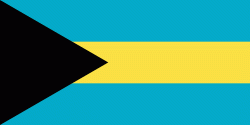
The Bahamas, officially the Commonwealth of The Bahamas, is an island country within the Lucayan Archipelago of the West Indies in the North Atlantic. It takes up 97% of the Lucayan Archipelago's land area and is home to 88% of the archipelago's population. The archipelagic state consists of more than 3,000 islands, cays, and islets in the Atlantic Ocean, and is located north of Cuba and northwest of the island of Hispaniola (split between the Dominican Republic and Haiti) and the Turks and Caicos Islands, southeast of the U.S. state of Florida, and east of the Florida Keys. The capital is Nassau on the island of New Providence. The Royal Bahamas Defence Force describes The Bahamas' territory as encompassing 180000 sqmi of ocean space.

The Bahama Islands were inhabited by the Lucayans, a branch of the Arawakan-speaking Taíno, for many centuries. Christopher Columbus was the first European to see the islands, making his first landfall in the "New World" in 1492 when he landed on the island of San Salvador. Later, the Spanish shipped the native Lucayans to and enslaved them on Hispaniola, after which the Bahama islands were mostly deserted from 1513 until 1648, nearly all native Bahamians having been forcibly removed for enslavement or having died of diseases that Europeans brought to the islands. In 1649, English colonists from Bermuda, known as the Eleutheran Adventurers, settled on the island of Eleuthera.
Currency / Language  
ISO Currency Symbol Significant figures
BSD Bahamian dollar $ 2
ISO Language
EN English language
Neighbourhood - Country  
Administrative Subdivision
City, Village,...