Nickerie District (Distrikt Nickerie)
Nickerie is a district of Suriname, on the north-west coast. Nickerie's capital city is Nieuw-Nickerie. Another town is Wageningen. The district borders the Atlantic Ocean to the north, the Surinamese district of Coronie to the east, the Surinamese district of Sipaliwini to the south and the region of East Berbice-Corentyne in Guyana to the west.
Nickerie has a population of 36.639 (2004) and an area of 5,353 km2. Nickerie's population includes East Indian, Javanese, Afro-Surinamese, Chinese, and Europeans.
Nickerie is bordered with Guyana. There is no bridge between the countries, but there is a ferry that sails between Molson Creek in Guyana and South Drain.
Nickerie District was originally settled by Amerindians. Near the Wonotobo Falls, a settlement was discovered which dates from the 1st century BC. Between the 6th and 16th century some terpen (artificial mounts) were built in the coastal area of which Hertenrits is the best known. In 1613, a tobacco plantation was established on the Courantyne River, however it disappeared without a trace.
In 1718, Dietzel became the first person to successfully settle in the area. In 1797, governor Jurriaan François de Friderici approved the first plantation in Nickerie. A large number of Scottish and English settlers arrived in the area during the British Occupation, and primarily grew cotton and coffee. The capital Nieuw Nickerie was built in 1879 after the former center of the district, Nieuw Rotterdam, was destroyed by floods.
The name Nickerie is probably based on Neekeari which was first reported by Teenstra in 1596 for an indigenous tribe living the area. The name also appears in Robert Dudley's The Voyage of Robert Dudley to the West-Indies, 1594-1595.
Nickerie had a poor connection to Paramaribo. It was not until 1960s when the East-West Link was constructed linking Nickerie with the rest of the country.
Map - Nickerie District (Distrikt Nickerie)
Map
Country - Suriname
 |
 |
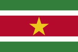
| Flag of Suriname | |
It has a population of approximately, dominated by descendants from the slaves and labourers brought in from Africa and Asia by the Dutch Empire and Republic. Most of the people live by the country's (north) coast, in and around its capital and largest city, Paramaribo. It is also one of the least densely populated countries on Earth. Situated slightly north of the equator, Suriname is a tropical country covered in rainforests. Its extensive tree cover is vital to the country's efforts to mitigate climate change and maintain carbon negativity. A developing country with a relatively high level of human development, Suriname's economy is heavily dependent on its abundant natural resources, namely bauxite, gold, petroleum, and agricultural products.
Currency / Language
| ISO | Currency | Symbol | Significant figures |
|---|---|---|---|
| SRD | Surinamese dollar | $ | 2 |
| ISO | Language |
|---|---|
| NL | Dutch language |
| EN | English language |
| JV | Javanese language |


