Ngiwal (State of Ngiwal)
Ngiwal is one of the sixteen states of Palau. It has a population of 282 (census 2015) and an area of 26 km2
On June 21, 2018, Japan ambassador Toshiyuki Yamada gave Japan's multipurpose center to Ngiwal.
Ngiwal is situated between Melekeok and Ngaraard on the north central east coast of Babeldaob Island. Ngiwal extends from the coast to the Rael Kedam and includes the drainage of the Ngeredekuu River. The Ngeredekuu has its headwaters on the forested east flanks of the Rael Kedam and flows through a large northwest to southeast trending valley. A coastal ridge lies between the Ngeredekuu Valley and a broad sandy plain along the coast. The modern village of Ngiwal is located on a broad section of coastal plain north of the point known as Bkulatabriual and comprises the traditional villages of Ngermechau (south) and Ngercheluuk. The traditional villages were relocated to the coast in the mid-nineteenth century from their positions on the lower slopes of the coastal ridge.
Presently, most of the use of the land in Ngiwal is confined to gardens surrounding the modern village. Interspersed with these kitchen gardens are stands of agroforest which include coconut, and betelnut, breadfruit, almond trees, and banana plants. In and around many of the uninhabited villages are stands of coconut and betelnut palms, and occasionally patches of irregularly attended taro swamp gardens. Except for occasional forays to hunt pigeon or harvest special plants, there is little active use of most of the interior of Ngiwal.
The state has an area of 26 km2 and is known for its beautiful beaches. To get to Ngiwal by boat it is necessary to do it at high tide, although there is a pier a couple of kilometers south of the village which can be reached at any tide. Its administrative center and main locality is Ngerkeai. The state has at least 2 protected areas the Ngerbekuu Nature Reserve and the Ngemai Conservation Area.
Map - Ngiwal (State of Ngiwal)
Map
Country - Palau
 |
 |
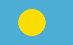
| Flag of Palau | |
The country was originally settled approximately 3,000 years ago by migrants from Maritime Southeast Asia. Palau was first drawn on a European map by the German missionary Paul Klein based on a description given by a group of Palauans shipwrecked on the Philippine coast on Samar. Palau islands were made part of the Spanish East Indies in 1885. Following Spain's defeat in the Spanish–American War in 1898, the islands were sold to Germany in 1899 under the terms of the German–Spanish Treaty, where they were administered as part of German New Guinea. After World War I, the islands were made a part of the Japanese-ruled South Seas Mandate by the League of Nations. During World War II, skirmishes, including the major Battle of Peleliu, were fought between American and Japanese troops as part of the Mariana and Palau Islands campaign. Along with other Pacific Islands, Palau was made a part of the United States-governed Trust Territory of the Pacific Islands in 1947. Having voted in a referendum against joining the Federated States of Micronesia in 1978, the islands gained full sovereignty in 1994 under a Compact of Free Association with the United States.
Currency / Language
| ISO | Currency | Symbol | Significant figures |
|---|---|---|---|
| USD | United States dollar | $ | 2 |
| ISO | Language |
|---|---|
| ZH | Chinese language |
| EN | English language |
| JA | Japanese language |


