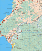
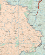
Nayarit (Estado de Nayarit)
 |
 |
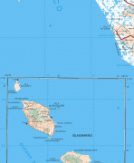
It is bordered by the states of Sinaloa to the northwest, Durango to the north, Zacatecas to the northeast and Jalisco to the south. To the west, Nayarit has a significant share of coastline on the Pacific Ocean, including the islands of Marías and Marietas. The beaches of San Blas and the so-called "Riviera Nayarit" are popular with tourists. Besides tourism, the economy of the state is based mainly on agriculture and fishing. It is also one of two states where the tarantula species Brachypelma klaasi is found, the other being Jalisco.
Home to Uto-Aztecan indigenous peoples such as the Huichol and Cora, the region was exposed to the conquistadores, Hernán Cortés and Nuño de Guzmán, in the 16th century. Spanish governance was made difficult by indigenous rebellions and by the inhospitable terrain of the Sierra del Nayar. The last independent Cora communities were subjugated in 1722. The state's name recalls the Cora people's label for themselves: Náayerite, commemorating Nayar, a resistance leader.
Radiocarbon dating estimate Aztatlán colonization of the western Mexican coast – including parts of Sinaloa, Nayarit and Jalisco – as occurring as early as 900 AD, with some evidence suggesting it might have been as early as 520 AD. Encountered on the western coast by the Spanish invaders in 1500, the cultures were descended from these original Aztatlán settlements and other Classic-stage cultures who had merged with them.
Hernán Cortés was the first known European to enter into the area now known as Nayarit, which he claimed for Spain as part of Nueva Galicia. Under Nuño de Guzmán, Spaniards took the region with considerable brutality, causing the indigenous inhabitants to revolt, in what was later referred to as the Mixtón War. After almost two centuries of resistance, the last independent Cora communities were incorporated into Spanish administration by force in 1722. Then followed intense missionary efforts by Jesuits to convert the indigenous.
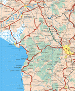
In the colonial period, the port of San Blas was one of the most important trade ports on the American Pacific coast. Galleons transporting goods from Manila, the Philippines arrived here before the rise of the port of Acapulco. Today, the town still boasts colonial architecture from its heyday, such as the aduana (customs office), the contaduría (accounting offices) and the fortress that protected the port against pirates.
In Nayarit, the struggle for independence from Spain was initiated by the priest José María Mercado, who conquered Tepic and San Blas before being defeated and executed by Spanish royalists. In 1824, in the first constitution of the Mexican Republic, Nayarit was a part of Jalisco. In the mid-1800s Comanche Indians, from Texas and Oklahoma, attacked Tepic causing widespread destruction. During the second half of the 19th century, Nayarit was one of the most turbulent territories in Mexico. The population was in open revolt, demanding access to land.
Nayarit was one of the last territories admitted as a state of the Mexican federation, which occurred on May 1, 1917.
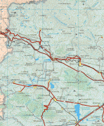
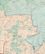
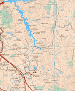
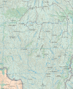
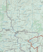
Map - Nayarit (Estado de Nayarit)
Map


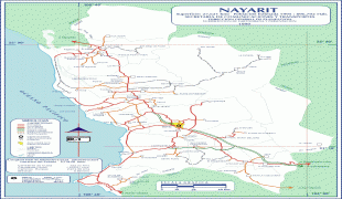


Country - Mexico


Currency / Language
| ISO | Currency | Symbol | Significant figures |
|---|---|---|---|
| MXV | Mexican Unidad de Inversion | 2 | |
| MXN | Mexican peso | $ | 2 |
| ISO | Language |
|---|---|
| ES | Spanish language |