Naryn Province (Naryn oblast)
The main highway runs from the Chinese border at Torugart Pass north to Balykchy on Issyk-Kul Lake. It is known as the location of Song Köl Lake and Chatyr-Kul Lake and Tash Rabat.
The population of Naryn oblast is 99% Kyrgyz. The economy is dominated by animal herding (sheep, horses, yaks), with wool and meat as the main products. Mining of various minerals developed during the Soviet era has largely been abandoned as uneconomical. Today the oblast is considered to be the poorest region in the country, but also the most typically Kyrgyz. It boasts beautiful mountains, alpine pastures, and Song Köl Lake which during summer months attracts large herds of sheep and horses with their herders and yurts.
The region was established on 21 November 1939 as Tien-Shan Region. On 20 December 1962, the region was dissolved, but on 11 December 1970 it was re-established as Naryn Region. On 5 October 1988 it was merged into Issyk-Kul Region, and, finally, on 14 December 1990, the Naryn Region was re-established.
Map - Naryn Province (Naryn oblast)
Map
Country - Kyrgyzstan
 |
 |
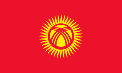
| Flag of Kyrgyzstan | |
Ethnic Kyrgyz make up the majority of the country's 6.6 million people, followed by significant minorities of Uzbeks and Russians. The Kyrgyz language is closely related to other Turkic languages.
Currency / Language
| ISO | Currency | Symbol | Significant figures |
|---|---|---|---|
| KGS | Kyrgyzstani som | Ñ | 2 |
| ISO | Language |
|---|---|
| KY | Kirghiz language |
| RU | Russian language |
| UZ | Uzbek language |


