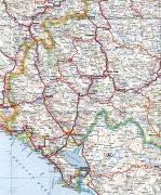
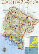
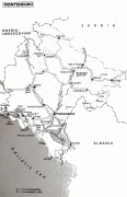
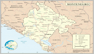
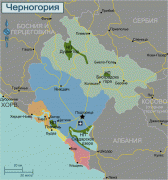
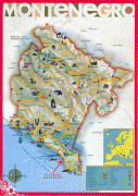
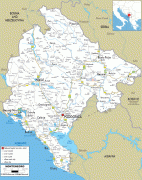
Montenegro
 |
 |
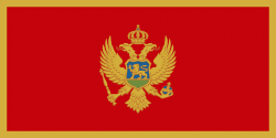
| Flag of Montenegro | |
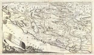
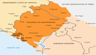
During the Early Medieval period, three principalities were located on the territory of modern-day Montenegro: Duklja, roughly corresponding to the southern half; Travunia, the west; and Rascia proper, the north. The Principality of Zeta emerged in the 14th and 15th centuries. From the late 14th century to the late 18th century, large parts of southern Montenegro were ruled by the Venetian Republic and incorporated into Venetian Albania. The name Montenegro was first used to refer to the country in the late 15th century. After falling under Ottoman Empire rule, Montenegro gained its semi-autonomy in 1696 under the rule of the House of Petrović-Njegoš, first as a theocracy and later as a secular principality. Montenegro's independence was recognised by the Great Powers at the Congress of Berlin in 1878. In 1910, the country became a kingdom.
After World War I, the kingdom became part of Yugoslavia. Following the breakup of Yugoslavia, the republics of Serbia and Montenegro together proclaimed a federation. Following an independence referendum held in May 2006, Montenegro declared its independence in June 2006 and the confederation dissolved.
Montenegro has an upper-middle-income economy and ranks 48th in the Human Development Index. It is a member of the United Nations, NATO, the World Trade Organization, the Organization for Security and Co-operation in Europe, the Council of Europe, and the Central European Free Trade Agreement. Montenegro is also a founding member of the Union for the Mediterranean, and is currently in the process of joining the European Union.
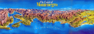
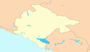
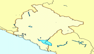
The country's English name derives from a Venetian calque of the Slavic "Crna Gora", meaning "Black Mountain", deriving from the appearance of Mount Lovćen which was covered in dense evergreen forests. Crna Gora, was mentioned for the first time in edicts issued by Stefan Uroš I to the Serbian Orthodox Zeta Episcopate seat at Vranjina island in Lake Skadar. It came to denote the majority of contemporary Montenegro in the 15th century. Modern-day Montenegro was more and more known by that name in the historical period following the fall of the Serbian Despotate. Originally, it had referred to only a small strip of land under the rule of the Paštrovići tribe, but the name eventually came to be used for the wider mountainous region after the Crnojević noble family took power in Upper Zeta. The aforementioned region became known as Stara Crna Gora 'Old Montenegro' by the 19th century to distinguish the independent region from the neighbouring Ottoman-occupied Montenegrin territory of Brda '(The) Highlands'. Montenegro further increased its size several times by the 20th century, as the result of wars against the Ottoman Empire, which saw the annexation of Old Herzegovina and parts of Metohija and southern Raška. Its borders have changed little since then, losing Metohija and gaining the Bay of Kotor.
After the second session of the AVNOJ during World War II in Yugoslavia, the contemporary modern state of Montenegro was founded as the Federal State of Montenegro (Montenegrin: Савезна држава Црне Горе / Savezna država Crne Gore) on 15 November 1943 within the Yugoslav Federation by the ZAVNOCGB. After the war, Montenegro became a republic under its name, the People's Republic of Montenegro (Montenegrin: Народна Република Црна Гора / Narodna Republika Crna Gora) on 29 November 1945. In 1963, it was renamed to the Socialist Republic of Montenegro (Montenegrin: Социјалистичка Република Црна Гора / Socijalistička Republika Crna Gora). As the breakup of Yugoslavia occurred, the SRCG was renamed to the Republic of Montenegro (Montenegrin: Република Црна Гора / Republika Crna Gora) on 27 April 1992 within the Federal Republic of Yugoslavia by removing the adjective "socialist" from the republic's title. Since 22 October 2007, a year after its independence, the name of the country became simply known as Montenegro.
Currency / Language
| ISO | Currency | Symbol | Significant figures |
|---|---|---|---|
| EUR | Euro | € | 2 |
| ISO | Language |
|---|---|
| SQ | Albanian language |
| BS | Bosnian language |
| HR | Croatian language |
| HU | Hungarian language |
| SR | Serbian language |