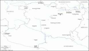
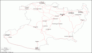
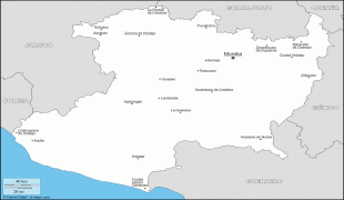
Michoacán (Estado de Michoacán de Ocampo)
 |
 |
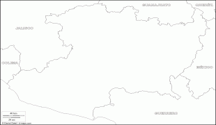
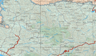
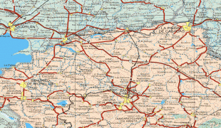
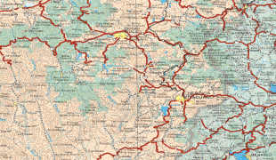
Michoacán is located in western Mexico, and has a stretch of coastline on the Pacific Ocean to the southwest. It is bordered by the states of Colima and Jalisco to the west and northwest, Guanajuato to the north, Querétaro to the northeast, the State of México to the east, and Guerrero to the southeast.
The name Michoacán is from Nahuatl: Michhuahcān from michhuah ("possessor of fish") and -cān (place of) and means "place of the fishermen" referring to those who fish on Lake Pátzcuaro. In pre-Hispanic times, the area was the home of the Purépecha Empire, which rivaled the Aztec Empire at the time of Spanish encounter. After the Spanish conquest, the empire became a separate province which became smaller over the colonial period. The state and its residents played a major role in the Mexican War of Independence.
Today, the state is still home to a sizable population of Purépecha people as well as minor populations of Otomi and Nahua. The economy is based on agriculture, ranching, fishing, mining, and the arts. The major tourism draw for the state is the Lake Pátzcuaro–Tzintzuntzan–Quiroga area, which was the center of the Purépecha Empire; as well as the location of the Tzintzuntzan yácata pyramids. The national and state parks which include the winter grounds of the monarch butterflies (Mariposas Monarca) are located here. Michoacán is known for its Spanish colonial towns. In 1991, Morelia was declared an UNESCO World Heritage Site for its well-preserved colonial buildings, pink stone cathedral, historic center, and aqueduct. Michoacán has eight Pueblos Mágicos; such as the towns of Tlalpujahua and Santa Clara del Cobre.
Day of the Dead celebrations in some parts of Michoacán, such as the towns of Janitzio and Pátzcuaro, are often considered to be the most elaborate and famous in all of Mexico. The famous Paricutín volcano, which is one of the Seven Natural Wonders of the World, is located near the city of Uruapan. The state is known as "the soul of Mexico".
According to archaeological evidence, there has been human habitation within the territory of the Mexican state of Michoacán for at least 10,000 years. In the pre-Hispanic period, there were waves of migration into the area, including the Pirinda, Nahua, Huetamo, Colima, Purépecha and other peoples. There are sites of formal settlements from all Mesoamerican periods. Important sites include El Opeño and those in Curutarán, Tepalcatepec, Apatzingán, Zinapécuaro and Coalcomán. The territory has been inhabited by the Nahua, Otomi, Matlatzinca, Pirinda and Teco peoples as well as the Purépecha. The main pre-Hispanic civilization of the state is that of the Purépecha, which was centered in the Lake Pátzcuaro area. Before the 13th century, both Nahua and Purépecha peoples were here, sustaining themselves by agriculture and fishing. The Purépecha are descendants of a late arrival of Chichimeca who came from the north. At Lake Patzcuaro, they came upon people with similar cultures to their own but who were more technological and socially advanced. The formation of the Purépechan state in the 13th century, when these people started their own dominion at Uayameo, today Santa Fé de la Laguna, and becoming dominant over the entire Lake Patzcuaro area by the 15th century. Conquest of neighboring tribes and territories occurred between 1401 and 1450, as they absorbed peoples with different cultures and languages into the empire. By the late 15th century, this state rivaled that of the Aztecs, having expanded their territory over much of what is now Michoacán and into part of Colima, Nayarit, Querétaro, Guanajuato, Guerrero and Jalisco. The Aztecs attempted to invade the Purépecha but were repelled. Because of this attack, the Purépecha later denied the Aztecs aid in their defense of Tenochtitlan against the Spanish and the Tlaxcala. The Purépechas are noted by historians to be one of the few rare instances in the Americas were the indigenous people had some experience with metallurgy prior to the arrival of the Europeans, especially coppersmithing and other metal ores located in their empire. Their descendants are still widely regarded for this today. Prior to the arrival of any Spaniard in the territory, then-ruler Zuanga died of smallpox, presumably carried by one of the Aztec delegations seeking military aid. He was succeeded by Tanganxoan II. The first Spaniard to the area was Cristóbal de Olid. The Spanish destruction of Tenochtitlan and their promise to allow him to remain ruler convinced Tanganxoan II to submit to Spanish rule. But, Nuño de Guzmán reneged on this agreement and killed Tanganxoan II in 1530, a crime for which he was tried and exiled to Spain where he would die in prison. During the first years of the Conquest, Michoacán was part of the "kingdom of Mexico" which included the current states of Mexico, Querétaro, Hidalgo, Tlaxcala, Oaxaca, Morelos, Guerrero, Veracruz, Tabasco, Michoacán, Guanajuato and parts of San Luis Potosí, Jalisco and Colima. These lands were divided into encomiendas among the conquistadors. The provinces with the largest populations were called Alcaldias Mayores, with Michoacán being one of these, with its capital initially at Tzintzuntzan. Soon after, it was moved to Patzcuaro and eventually settled in what is now Morelia. The provincial and later state capital was founded by viceroy Antonio de Mendoza in 1541. It became the political and ecclesiastical center of the province after the death of Vasco de Quiroga in 1565.
Soon after the Spanish Conquest, evangelists from the Franciscan, Augustinian, Carmelite and other orders established monasteries all over the territory. Some of the best-known are Juan de Moya, Martín de la Coruña and Jacob the Dacian. As first governor, Nuño de Guzmán disrupted and devastated the social and economic order of the area. Vasco de Quiroga succeeded Guzman, bringing Franciscan and Augustinian friars to both evangelize and repair the area's broken economy and social institutions. Quiroga founded the Spanish city of Patzcuaro in 1538, calling it the Ciudad de Mechuacán. For his efforts, Quiroga is still referred to in the Patzcuaro area as "Tata (grandfather) Vasco". The diocese of Michoacán was established in 1536 by Pope Paul III, and its boundaries coincide with the old Purépecha kingdom. Its first bishop was Vasco de Quiroga.
The Universidad Michoacana de San Nicolás de Hidalgo began as the Colegio de San Nicolas Obispo, founded by Vasco de Quiroga in Patzcuaro in 1540. It was originally a seminary for the training of evangelists. It was granted a royal seal in 1543 to become the Real Colegio de San Nicolás Obispo. The school was moved to Morelia in 1580 and was fused with the Colegio de San Miguel Guayangareo. In 1590, its name was changed to the Seminario Tridentino, afterwards to Seminario Conciliar in 1601. By the end of the 17th century, the name returned to Colegio de San Nicolás but its structure was profoundly changed, adding studies such as philosophy, civil law, and others. At the end of the 18th and beginning of the 19th centuries, a number of figures associated with the Mexican War of Independence, such as Miguel Hidalgo y Costilla, José María Morelos and others were associated with this school. By the mid-19th century, the school had been secularized and renamed the Primitivo y Nacional Colegio de San Nicolás de Hidalgo adding studies such as chemistry, physics and other sciences. The current name and organization was adopted after the Mexican Revolution in 1917.
From the 16th to the 18th centuries, Augustinian, Franciscan and Carmelite missions were constructed in the territory as well as civil constructions, especially in the city now known as Morelia. Mining in areas such as Angangueo, Tlalpujahua and Inguaran had begun, as well as the establishment of agricultural and livestock haciendas. The first school of higher education, called the Primera Casa de Altos Estudios en América, was founded by Alonso de la Veracruz in Tiripetío. Michoacán was made a separate province from "Mexico" in 1602. By the mid-17th century, the indigenous population had declined by half. In 1776, the territory of Michoacán was reduced to the area in which the modern states of Michoacán and Colima are now. Soon after, Colima split to join with the province of Guadalajara, leaving Michoacán roughly with the territory it has today.
During the entire colonial period, the economy was concentrated in the hands of the Spanish-born, who held vast lands and haciendas. They also held the rights over minerals mined in places such as Tlalpujahua, Angangueo and Huetamo. Indigenous peoples were exploited for their work, and slavery was not uncommon. Education was restricted for only those born in Spain and their descendants and was controlled by the Church. The main educational institutions were the Colegio de San Nicolas, founded in the 16th century; and the Seminary of San Pedro and San Pablo, founded in the 18th century. These schools produced a number of distinguished men, but the best-known is Miguel Hidalgo y Costilla. At the end of the 18th century, ideas from Europe began to infiltrate the upper classes of the state, especially in Valladolid (Morelia) and Zamora. These would eventually lead to the Mexican War of Independence in the early 18th century. This war was foreshadowed by the 1809 conspiracy in Valladolid.
Map - Michoacán (Estado de Michoacán de Ocampo)
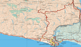
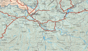
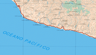
Map


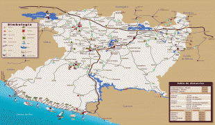
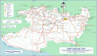
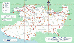


Country - Mexico


Currency / Language
| ISO | Currency | Symbol | Significant figures |
|---|---|---|---|
| MXV | Mexican Unidad de Inversion | 2 | |
| MXN | Mexican peso | $ | 2 |
| ISO | Language |
|---|---|
| ES | Spanish language |
