Masvingo Province (Masvingo Province)
Masvingo Province is bordered by Matabeleland South Province to the southwest, Midlands Province to the northwest, Manicaland Province to the northeast, and Mozambique to the southeast. It has an area of 56566 km2, equal to 14.48% of the total area of Zimbabwe. It is the third-largest in area of Zimbabwe's provinces, after Matabeleland North and Mashonaland West. A diverse province, the Karanga, a Shona subgroup, form the majority, with minorities of Shangani in the southeast and Ndebele in the west. Its economy is largely centered around agriculture and tourism. Masvingo Province is home to the Great Zimbabwe ruins, a World Heritage Site and major tourist attraction.
The town of Masvingo was founded in 1890 and was the first large settlement to be established by the Pioneer Column of the British South Africa Company which makes it the oldest town in Zimbabwe. It was named Fort Victoria after Queen Victoria.
The province is largely populated by members of the Karanga tribe, who are the most populous tribe in Zimbabwe, and are a sub-group of the Shona speaking tribes that also include the Zezuru, Manyika and Ndau. Masvingo province, known before 1982 as Victoria province, is in the drier lowveldt area in the south of Zimbabwe. The boundaries were changed slightly in the 1980s. From white settlement until 2000 most of the area was devoted to cattle ranching, with mining and sugar cane growing (irrigated from Lake Mutirikwi), and communal areas where subsistence farming is carried out. With the land reforms of the early 21st century large scale cattle and mixed farms are being redistributed to small farmers.
Map - Masvingo Province (Masvingo Province)
Map


Country - Zimbabwe
 |
 |
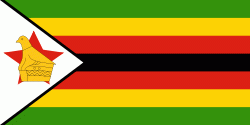
| Flag of Zimbabwe | |
The British South Africa Company of Cecil Rhodes demarcated the Rhodesia region in 1890 when they conquered Mashonaland and later in 1893 Matabeleland after a fierce resistance by Matabele people known as the First Matabele War. Company rule ended in 1923 with the establishment of Southern Rhodesia as a self-governing British colony. In 1965, the white minority government unilaterally declared independence as Rhodesia. The state endured international isolation and a 15-year guerrilla war with black nationalist forces; this culminated in a peace agreement that established universal enfranchisement and de jure sovereignty as Zimbabwe in April 1980. Zimbabwe then joined the Commonwealth of Nations, from which it was suspended in 2002 for breaches of international law by its government under Robert Mugabe and from which it withdrew in December 2003.
Currency / Language
| ISO | Currency | Symbol | Significant figures |
|---|---|---|---|
| ZWL | Zimbabwean dollar | 2 |
| ISO | Language |
|---|---|
| SN | Shona language |


