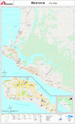
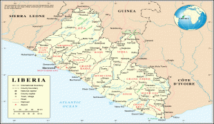
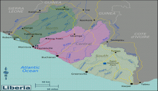
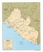
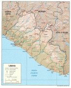
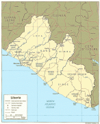
Liberia (Republic of Liberia)
 |
 |
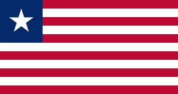
| Flag of Liberia | |
Liberia began in the early 19th century as a project of the American Colonization Society (ACS), which believed black people would face better chances for freedom and prosperity in Africa than in the United States. Between 1822 and the outbreak of the American Civil War in 1861, more than 15,000 freed and free-born African Americans, along with 3,198 Afro-Caribbeans, relocated to Liberia. Gradually developing an Americo-Liberian identity, the settlers carried their culture and tradition with them. Liberia declared independence on July 26, 1847, which the U.S. did not recognize until February 5, 1862.
Liberia was the first African republic to proclaim its independence and is Africa's first and oldest modern republic. It was among the few African countries to maintain its sovereignty during the Scramble for Africa. During World War II, Liberia supported the United States war effort against Germany, and in turn received considerable American investment in infrastructure, which aided the country's wealth and development. President William Tubman encouraged economic and political changes that heightened the country's prosperity and international profile; Liberia was a founding member of the League of Nations, United Nations, and the Organisation of African Unity.
The Americo-Liberian settlers did not relate well to the indigenous peoples they encountered. Colonial settlements were raided by the Kru and Grebo from their inland chiefdoms. Americo-Liberians formed into a small elite that held disproportionate political power; indigenous Africans were excluded from birthright citizenship in their own land until 1904.
In 1980, political tensions from the rule of William R. Tolbert resulted in a military coup during which Tolbert was killed, marking the end of Americo-Liberian rule in the country and beginning over two decades of political instability. Five years of military rule by the People's Redemption Council and five years of civilian rule by the National Democratic Party of Liberia were followed by the First and Second Liberian Civil Wars. These resulted in the deaths of 250,000 people (about 8% of the population) and the displacement of many more, with Liberia's economy shrinking by 90%. A peace agreement in 2003 led to democratic elections in 2005.
Currency / Language
| ISO | Currency | Symbol | Significant figures |
|---|---|---|---|
| LRD | Liberian dollar | $ | 2 |
| ISO | Language |
|---|---|
| EN | English language |