Lajes Field (Lajes Field)
Lajes Field or Lajes Air Base (Base Aérea das Lajes), officially designated Air Base No. 4 (Base Aérea Nº 4, BA4), is a multi-use airfield near Lajes and 15 km northeast of Angra do Heroísmo on Terceira Island in the Azores, Portugal. It is home to the Portuguese Air Force Base Aérea N º4 and Azores Air Zone Command (Comando da Zona Aérea dos Açores), a United States Air Force detachment unit (operated by the 65th Air Base Group of United States Air Forces in Europe - Air Forces Africa), and a regional air passenger terminal. Located about 3680 km east of New York City and about 1600 km west of Lisbon, Portugal; the base sits in a strategic location midway between North America and Europe in the north Atlantic Ocean.
The origin of the Lajes Field dates back to 1928, when Portuguese Army Lieutenant colonel Eduardo Gomes da Silva wrote a report on the possible construction of an airfield in the plainland of Lajes, for that branch's aviation service (Aeronáutica Militar). However, the location of Achada on the island of São Miguel was chosen instead at the time for the construction of the field. In 1934, the Achada airfield was condemned due to its inadequate dimensions and adverse weather conditions, resulting in the construction of a landing strip of packed earth and a small group of support facilities by the Portuguese military at Lajes.
The origin of the Lajes Field dates back to 1928, when Portuguese Army Lieutenant colonel Eduardo Gomes da Silva wrote a report on the possible construction of an airfield in the plainland of Lajes, for that branch's aviation service (Aeronáutica Militar). However, the location of Achada on the island of São Miguel was chosen instead at the time for the construction of the field. In 1934, the Achada airfield was condemned due to its inadequate dimensions and adverse weather conditions, resulting in the construction of a landing strip of packed earth and a small group of support facilities by the Portuguese military at Lajes.
| IATA Code | TER | ICAO Code | LPLA | FAA Code | |
|---|---|---|---|---|---|
| Telephone | Fax | ||||
| Home page |
Map - Lajes Field (Lajes Field)
Map
Country - Portugal
 |
 |
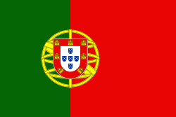
| Flag of Portugal | |
One of the oldest countries in Europe, its territory has been continuously settled, invaded and fought over since prehistoric times. The territory was first inhabited by pre-Roman and Celtic peoples who had contact with Phoenicians, ancient Greeks and Carthaginians. It was later ruled by the Romans, followed by the invasions of Germanic peoples and the Islamic invasion by the Moors, whose rule was eventually expelled during the Reconquista. Founded first as a county of the Kingdom of León in 868, gained its independence as the Kingdom of Portugal with the Treaty of Zamora in 1143.
Currency / Language
| ISO | Currency | Symbol | Significant figures |
|---|---|---|---|
| EUR | Euro | € | 2 |
| ISO | Language |
|---|---|
| PT | Portuguese language |


