Katanga (Katanga Province)
Katanga's area encompassed 497000 km2. Farming and ranching are carried out on the Katanga Plateau. The eastern part of the province is considered to be a rich mining region, which supplies cobalt, copper, tin, radium, uranium, and diamonds. The region's former capital, Lubumbashi, is the second-largest city in the Congo.
Copper mining in Katanga dates back over 1,000 years, and mines in the region were producing standard-sized ingots of copper for international transport by the end of the 10th century CE.
In the 1890s, the province was beleaguered from the south by Cecil Rhodes' Northern Rhodesia, and from the north by the Belgian Congo, the personal possession of King Leopold II of Belgium. Msiri, the King of Katanga, held out against both, but eventually Katanga was subsumed by the Belgian Congo.
After 1900, the Societe Generale de Belgique practically controlled all of the mining in the province through Union Minière du Haut Katanga (UMHK). This included uranium, radium, copper, cobalt, zinc, cadmium, germanium, manganese, silver, gold, and tin.
In 1915, a deposit of pitchblende and other uranium minerals of a higher grade than had ever been found before anywhere in the world and higher than any found since were discovered at Shinkolobwe. The discovery was kept secret by UMHK. After World War I ended a factory was built at Olen; the secrecy was lifted at the end of 1922 with the announcement of the production of the first gram of radium from the pitchblende. By the start of World War II, the mining companies "constituted a state within the Belgian Congo". The Shinkolobwe mine near Jadotville (now Likasi) was at the centre of the Manhattan Project.
In 1960, after the Democratic Republic of the Congo (then called Republic of the Congo) gained independence from Belgium, the UMHK, Moise Tshombe and Godefroid Munongo supported the secession of Katanga province from the Congo. This was supported by Belgium but opposed by the Congolese Prime Minister Patrice Lumumba. This led to the assassination of Lumumba and the Katanga Crisis (or "Congo Crisis"), which lasted from 1960 to 1965. The breakaway State of Katanga existed from 1960 to 1963.
In 2005, the new constitution specified that Katanga was to be split up into separately administered provinces.
Militias such as Mai Mai Kata Katanga led by Gédéon Kyungu Mutanga fought for Katanga to secede, and his group briefly took over the provincial capital Lubumbashi in 2013.
In 2015, Katanga Province was split into the constitutional provinces of Tanganyika, Haut-Lomami, Lualaba, and Haut-Katanga.
Map - Katanga (Katanga Province)
Map
Country - Democratic_Republic_of_the_Congo
 |
 |
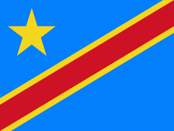
| Flag of the Democratic Republic of the Congo | |
Centered on the Congo Basin, the territory of the DRC was first inhabited by Central African foragers around 90,000 years ago and was reached by the Bantu expansion about 3,000 years ago. In the west, the Kingdom of Kongo ruled around the mouth of the Congo River from the 14th to 19th centuries. In the northeast, center and east, the kingdoms of Azande, Luba, and Lunda ruled from the 16th and 17th centuries to the 19th century. King Leopold II of Belgium formally acquired rights to the Congo territory in 1885 and declared the land his private property, naming it the Congo Free State. From 1885 to 1908, his colonial military forced the local population to produce rubber and committed widespread atrocities. In 1908, Leopold ceded the territory, which thus became a Belgian colony.
Currency / Language
| ISO | Currency | Symbol | Significant figures |
|---|---|---|---|
| CDF | Congolese franc | Fr | 2 |
| ISO | Language |
|---|---|
| FR | French language |
| KG | Kongo language |
| LN | Lingala language |


