Karibib
Karibib (Otjandjomboimwe) is a town in the Erongo Region of western Namibia. It has 3,800 inhabitants and owns 97 km2 of town land. Karibib is the district capital of the Karibib electoral constituency. It is situated on the Khan River, halfway between Windhoek and Swakopmund on the B2 (Trans-Kalahari Highway), the main road between the Walvis Bay and Johannesburg. The town is known for its aragonite marble quarries and the Navachab Gold Mine.
Karibib was a waterhole known to the Herero under the name Otjandjomboimwe. Expecting business opportunities arising from the railway construction work between Swakopmund and Windhoek, Eduard Hälbich, merchant at Otjimbingwe, bought the waterhole and 20,000 hectares of land surrounding it from Herero headman Zacharias Zeraua. The deal was finalised on 7 January 1895, the purchase price was 22,500 marks (ℳ), two ox wagons, and 742 pounds 5 shillings that Zeraua had incurred in debts in Hälbich's shop in Otjimbingwe.
Karibib began to grow quickly when on 30 May 1900 the railway construction reached the newly founded place. 1 June 1900 marks the day of the official foundation of Karibib at the occasion of the first train arriving from Swakopmund. The railway station was built, a medical practice, storage facilities, a prison, and living quarters were erected, and the population rose to 274. This development disadvantaged the settlement of Otjimbingwe; ox wagons that before would travel via Otjimbingwe on the Alter Baiweg (Old bay path) would now take the route through Karibib.
In 1904 the place became again important as a railway hub for ferrying troops in the Herero and Namaqua War. Its status was upgraded to that of a county, and governance was extended to include Omaruru. At the end of the war in 1907, Karibib counted 316 white residents, and the remaining Herero land was expropriated and offered to white farmers. Karibib was declared a municipality in 1909, and Eduard Hälbich was its mayor.
Map - Karibib
Map
Country - Namibia
 |
 |
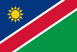
| Flag of Namibia | |
The driest country in sub-Saharan Africa, Namibia has been inhabited since pre-historic times by the San, Damara and Nama people. Around the 14th century, immigrating Bantu peoples arrived as part of the Bantu expansion. Since then, the Bantu groups, the largest being the Ovambo, have dominated the population of the country; since the late 19th century, they have constituted a majority. Today Namibia is one of the least densely populated countries in the world.
Currency / Language
| ISO | Currency | Symbol | Significant figures |
|---|---|---|---|
| NAD | Namibian dollar | $ | 2 |
| ZAR | South African rand | Rs | 2 |
| ISO | Language |
|---|---|
| AF | Afrikaans language |
| EN | English language |
| DE | German language |
| HZ | Herero language |


