Kakata
Kakata (pronounced Kak-ah-tah), is the capital city of Liberia's Margibi County and is located in Kakata District just over the Du River bridge which is its border with Todee District. It is a transit town at the heart of the historical natural rubber cultivation belt in Liberia. The city is colloquially known as "Kak City". The City host the Office of the National Civil Society Council of Liberia (NCSCL), Margibi Chapter. The Council which is headed by Mr. Friday Edwin CRUSOR, is known for its diligent role in Advocacy, Dialogue, Peacebuilding among others.
It is estimated that the city is surrounded by more than one hundred thousand acres of rubber plantations, most of which are now past latex production. Though the Salala Rubber Company and Firestone Liberia are not far from Kakata, the nearby rubber plantations are mostly privately owned. Morris American Rubber Company (MARCO) and Bright Farm are the two largest, and Liberian-owned plantations, by area around Kakata. Small and medium-holder rubber plantations also dot most of the landscape.
Kakata has many primary and secondary schools. One of the most notable is Booker Washington Institute (BWI), Liberia's premiere vocational high school and technical institution. It also hosts KRTTI, [Kakata Rural Teacher Training Institute], which trains Liberian elementary, lower-grade and secondary teachers. It has Ten Senior High Schools: St. Christopher Catholic High School, St. Augustine, Methodist, Pentecostal Conquerors Academy, Kakata Community College, Francis Michell, Lango Lippaye, St. Paul Lutheran, Kakata YMCA and BWI. Lango Lippaye and Harbel Multilateral are the two Government Senior High Schools in Margibi county. There are five government junior high schools: the KRTTI Demonstration school, E. J. Yancy, Special Project, E. J. Yancy Annex and Lango Lippaye. Students from all over Liberia come to Kakata for studies at these institutions.
C. H. Rennie Hospital in Kakata is the only government referral hospital in the County and it is the headquarters for the Margibi County health team. The Firestone Duside Hospital in Harbel is the nearest referral health care facility.
Kakata has a large daily market in the center of town. Kakata is a meeting point between urban and rural Liberia: Many of Kakata’s inhabitants either travel to Monrovia to bring goods to Kakata to sell or travel to the rural areas, to bring production back to Kakata to sell. The primary groups are Kpelle and Bassa, but all the different groups from across Liberia are represented in Kakata.
As of the 2008 census, Kakata has a population of 33,945. Of this, 16,501 were male and 17,444 female; it is the fifth most populous urban area in Liberia.
Radio is one of the main source of news and community engagement. The prominent stations broadcasting in Kakata are:
* Radio Kakata FM 101.7 MHz
* Atlantic Radio FM 92.7 MHz
* Radio Margibi FM 103.9 MHz
Map - Kakata
Map
Country - Liberia
 |
 |
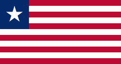
| Flag of Liberia | |
Liberia began in the early 19th century as a project of the American Colonization Society (ACS), which believed black people would face better chances for freedom and prosperity in Africa than in the United States. Between 1822 and the outbreak of the American Civil War in 1861, more than 15,000 freed and free-born African Americans, along with 3,198 Afro-Caribbeans, relocated to Liberia. Gradually developing an Americo-Liberian identity, the settlers carried their culture and tradition with them. Liberia declared independence on July 26, 1847, which the U.S. did not recognize until February 5, 1862.
Currency / Language
| ISO | Currency | Symbol | Significant figures |
|---|---|---|---|
| LRD | Liberian dollar | $ | 2 |
| ISO | Language |
|---|---|
| EN | English language |


