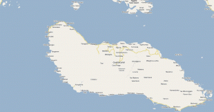
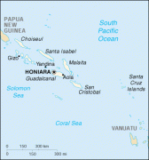
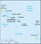
Honiara
 |
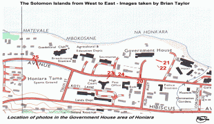
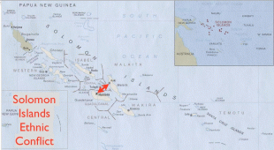
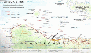
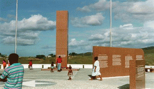
The airport area to the east of Honiara was the site of a battle between the United States and the Japanese during the Guadalcanal Campaign in World War II, the Battle of Henderson Field of 1942, from which America emerged victorious. After Honiara became the new administrative centre of the British Solomon Islands Protectorate in 1952 with the addition of many administrative buildings, the town began to develop and grow in population. Since the late 1990s, Honiara has suffered a turbulent history of ethnic violence and political unrest and is scarred by rioting. A coup attempt in June 2000 resulted in violent rebellions and fighting between the ethnic Malaitans of the Malaita Eagle Force (MEF) and the Guadalcanal natives of the Isatabu Freedom Movement (IFM).
Although a peace agreement was made in October 2000, violence ensued in the city streets in March 2002 when two diplomats from New Zealand and several others were murdered. In July 2003, conditions had become so bad in Honiara that the Regional Assistance Mission to Solomon Islands (RAMSI), consisting of multiple Pacific nations under Australian leadership, was invited into the country by the Solomons Government to restore order. In 2006, riots broke out following the election of Snyder Rini as Prime Minister, destroying a part of Chinatown and making more than 1,000 Chinese residents homeless. The riots devastated the town and tourism in the city and the islands was severely affected.
Honiara contains the majority of the major government buildings and institutions of Solomon Islands. The National Parliament of Solomon Islands, Honiara Solomon Islands College of Higher Education, International School in Honiara and University of the South Pacific Solomon Islands are located in Honiara as is the national museum and Honiara Market. Politically Honiara is divided into three parliamentary constituencies, electing three of the 50 members of the National Parliament. These constituencies, East Honiara, Central Honiara and West Honiara, are three of only six constituencies in the country to have an electorate of over 10,000 people.
Honiara is predominantly Christian and is served by the headquarters of the Church of the Province of Melanesia (Anglican), the Roman Catholic Archdiocese of Honiara, the South Seas Evangelical Church, the United Church, the Seventh-day Adventist Church and other Christian churches.
As of the 2021 census, Honiara's population is 92,344. This makes Honiara the most populous city in the Solomon Islands. It is also the fastest-growing population center in the Solomon Islands. The population skews quite young; approximately 50% of Honiara's residents are younger than 30.
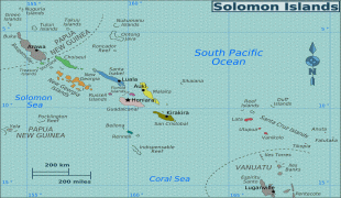
Map - Honiara
Map


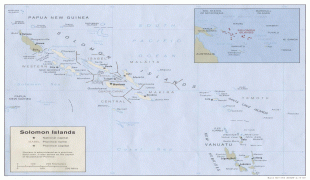
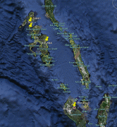
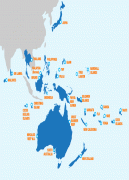

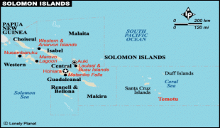


Country - Solomon_Islands
 |
 |
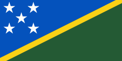
| Flag of the Solomon Islands | |
The islands have been settled since at least some time between 30,000 and 28,800 BCE, with later waves of migrants, notably the Lapita people, mixing and producing the modern indigenous Solomon Islanders population. In 1568, the Spanish navigator Álvaro de Mendaña was the first European to visit them. Though not named by Mendaña, it is believed that the islands were called "the Solomons" by those who later received word of his voyage and mapped his discovery. Mendaña returned decades later, in 1595, and another Spanish expedition, led by Portuguese navigator Pedro Fernandes de Queirós, visited the Solomons in 1606. Britain defined its area of interest in the Solomon Islands archipelago in June 1893, when Captain Gibson, R.N., of HMS Curacoa (1878), declared the southern Solomon Islands a British protectorate. During World War II, the Solomon Islands campaign (1942–1945) saw fierce fighting between the United States, British Commonwealth forces and the Empire of Japan, including the Battle of Guadalcanal.
Currency / Language
| ISO | Currency | Symbol | Significant figures |
|---|---|---|---|
| SBD | Solomon Islands dollar | $ | 2 |
| ISO | Language |
|---|---|
| EN | English language |