Guéra Region (Guera Region)
The region borders Batha Region to the north, Sila Region and Salamat Region to the east, Moyen-Chari Region to the south, and Chari-Baguirmi Region and Hadjer-Lamis Region to the west. The region contains several mountainous areas, such as the Kadam Massif and the Guéra Massif, the latter of which is composed of granites dissected by numerous dolerite dykes.
The Guéra Region receives an annual rainfall of 744 mm. The region is the principal agricultural producing area in the whole country, producing cotton and groundnuts, the two main cash-crops of the country, as well as rice.
Half of the Zakouma National Park lies within the region.
Map - Guéra Region (Guera Region)
Map
Country - Chad
 |
 |
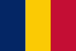
| Flag of Chad | |
Chad has several regions: a desert zone in the north, an arid Sahelian belt in the centre and a more fertile Sudanian Savanna zone in the south. Lake Chad, after which the country is named, is the second-largest wetland in Africa. Chad's official languages are Arabic and French. It is home to over 200 different ethnic and linguistic groups. Islam (55.1%) and Christianity (41.1%) are the main religions practiced in Chad.
Currency / Language
| ISO | Currency | Symbol | Significant figures |
|---|---|---|---|
| XAF | Central African CFA franc | Fr | 0 |
| ISO | Language |
|---|---|
| AR | Arabic language |
| FR | French language |


