Guinguinéo
Guinguinéo is a township in Kaolack Region in the center of Senegal, situated 22 km to the northeast of Kaolack. Before 1956, Guinguinéo experienced the phenomenon of kingdoms piloted by a succession of kings of whom the most famous was Maad Saloum Fode N'Gouye Joof (French: Fodé Diouf). Guinguinéo became a commune in 1956 and a full municipality in 1960. The first mayor was Doctor Charles Ndiaye.
Guinguinéo is served by a station on the main line of Dakar-Niger Railway and is also the junction for the branch line to Lydiane. However people mainly use the road for their travel because of the poor state of the train system. Guinguinéo occupied for a long time a good position on the railroad in Senegal, being the second station of the rail system after Thies, which is one reason why the town delayed making an asphalted road to join it directly with the other settlements of the country. The only road joining Guinguineo to the rest of Senegal is the small road section from Guinguineo to Back Samba Dior.
In the town itself journeys are made by horse-drawn vehicles or primarily on foot, as Guinguinéo is not well provided with roads.
Map - Guinguinéo
Map


Country - Senegal
 |
 |
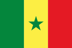
| Flag of Senegal | |
Senegal is notably the westernmost country in the mainland of the Old World, or Afro-Eurasia. It owes its name to the Senegal River, which borders it to the east and north. The climate is typically Sahelian, though there is a rainy season. Senegal covers a land area of almost 197000 km2 and has a population of around million. The state is a unitary presidential republic; since the country's foundation in 1960, it has been recognized as one of the most stable countries on the African continent.
Currency / Language
| ISO | Currency | Symbol | Significant figures |
|---|---|---|---|
| XOF | West African CFA franc | Fr | 0 |
| ISO | Language |
|---|---|
| FR | French language |
| WO | Wolof language |