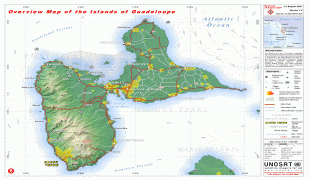
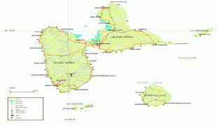
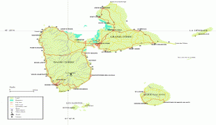
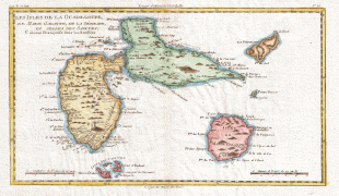
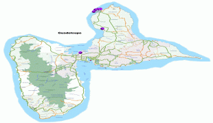
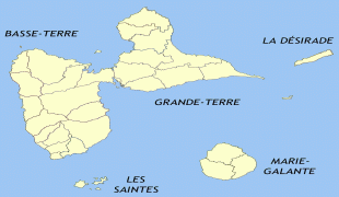
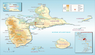
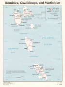
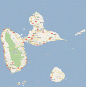
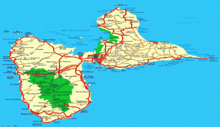
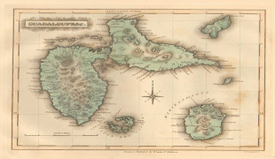
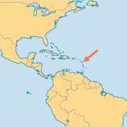
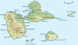
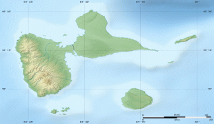
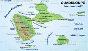
Map - Guadeloupe

Guadeloupe
Guadeloupe (Gwadloup, ) is an archipelago and overseas department and region of France in the Caribbean. It consists of four inhabited islands—Basse-Terre, Grande-Terre, Marie-Galante, La Désirade, and the two inhabited Îles des Saintes—as well as many uninhabited islands and outcroppings. It is south of Antigua and Barbuda and Montserrat, north of the Commonwealth of Dominica. The region's capital city is Basse-Terre, located on the southern west coast of Basse-Terre Island; however, the most populous city is Les Abymes and the main centre of business is neighbouring Pointe-à-Pitre, both located on Grande-Terre Island. It had a population of 384,239 in 2019.

Like the other overseas departments, it is an integral part of France. As a constituent territory of the European Union and the Eurozone, the euro is its official currency and any European Union citizen is free to settle and work there indefinitely. However, as an overseas department, it is not part of the Schengen Area. The region formerly included Saint Barthélemy and Saint Martin, which were detached from Guadeloupe in 2007 following a 2003 referendum.

Christopher Columbus visited Guadeloupe in 1493, during his second voyage, and gave the island its name. The official language is French; Antillean Creole is also spoken.

The archipelago was called Karukera (or "The Island of Beautiful Waters") by the native Arawak people.

Christopher Columbus named the island Santa María de Guadalupe in 1493 after Our Lady of Guadalupe, a shrine to the Virgin Mary venerated in the Spanish town of Guadalupe, Extremadura. When the area became a French colony, the Spanish name was retained - though altered to French orthography and phonology. The islands are locally known as Gwada.

 
Map - Guadeloupe
Map
Google Earth - Map - Guadeloupe
Google Earth
Openstreetmap - Map - Guadeloupe
Openstreetmap
Guadeloupe-Overview-...
4546x3217
mappery.com
Guadeloupe-Overview-...
4546x3217
www.mappery.com
Map-guadeloupe.jpg
4048x3275
upload.wikimedia.org
large_detailed_map_o...
4048x3275
www.vidiani.com
from-india-to-guadel...
3508x2480
danmugerin.files.wor...
1780_Raynal_and_Bonn...
2500x1707
upload.wikimedia.org
large_detailed_road_...
2000x1783
www.vidiani.com
Gua
1817x1633
upload.wikimedia.org
large_detailed_road_...
1749x1500
www.vidiani.com
guadeloupe-map.jpg
1749x1500
www.globalcitymap.co...
large_detailed_polit...
1087x1456
www.vidiani.com
guadeloupe.jpg
1193x1200
www.footiemap.com
gp_map2.jpg
1165x1063
www.weltrekordreise....
large_detailed_road_...
1165x1063
www.vidiani.com
LUCASF020388.jpg
1200x991
www.pennymead.com
guad-LMAP-md.png
965x969
www.operationworld.o...
guadeloupeestpop.gif
1102x844
www.routard.com
Map_Guadeloupe_Be.pn...
1100x843
upload.wikimedia.org
large_detailed_relie...
1015x890
www.vidiani.com
karte-8-170.gif
864x681
www.welt-atlas.de
Administrative Subdivision
Country, State, Region,...