Gegharkunik Province (Geghark’unik’i Marz)
Gegharkunik Province is located at the eastern part of Armenia, bordering Azerbaijan. It includes the exclave of Artsvashen, which has been under Azerbaijani occupation since the First Nagorno-Karabakh War. With an area of 5348 km2, Gegharkunik is the largest province in Armenia. However, approximately 24% or 1278 km2 of its territory is covered by Lake Sevan, the largest lake in the South Caucasus and a major tourist attraction of the region.
The Yerevan-Sevan-Dilijan republican highway runs through the province.
The early Armenian history Movses Khorenatsi connected the name of Gegharkunik with Gegham, a 5th-generation descendant of the legendary patriarch and founder of the Armenian nation Hayk. Gegham was the father of Sisak (founder of the Siunia dynasty) and Harma (grandfather of Ara the Beautiful). The Gegham Mountains and the Lake of Gegham (currently known as Lake Sevan) were also named after Gegham.
The region of Gegharkunik has been connected to Uelikuni/Uelikuhi, attested in Urartian sources as one of the local "kingdoms" conquered by Urartu in the eighth century BCE. The word "Uel" is believed to be an early (proto-Armenian) version of "Gegh" (proto-Indo European u corresponds with g in Armenian, l corresponds with the Armenian gh).
Armenian gull is the symbol of the province. It is depicted on the Gegharkunik coat of arms adopted on 4 May 2011, flying over the Lake Sevan and its peninsula, surrounded by the mountains of Sevan. The wheat ears on both sides of the coat of arms represent the agricultural characteristic of the province, while the opened book at the bottom represents the intellectual and cultural heritage of the region.
Map - Gegharkunik Province (Geghark’unik’i Marz)
Map


Country - Armenia
 |
 |
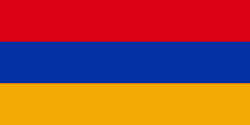
| Flag of Armenia | |
Armenia is a unitary, multi-party, democratic nation-state with an ancient cultural heritage. The first Armenian state of Urartu was established in 860 BC, and by the 6th century BC it was replaced by the Satrapy of Armenia. The Kingdom of Armenia reached its height under Tigranes the Great in the 1st century BC and in the year 301 became the first state in the world to adopt Christianity as its official religion. The ancient Armenian kingdom was split between the Byzantine and Sasanian Empires around the early 5th century. Under the Bagratuni dynasty, the Bagratid Kingdom of Armenia was restored in the 9th century. Declining due to the wars against the Byzantines, the kingdom fell in 1045 and Armenia was soon after invaded by the Seljuk Turks. An Armenian principality and later a kingdom Cilician Armenia was located on the coast of the Mediterranean Sea between the 11th and 14th centuries.
Currency / Language
| ISO | Currency | Symbol | Significant figures |
|---|---|---|---|
| AMD | Armenian dram | Ö | 2 |
| ISO | Language |
|---|---|
| HY | Armenian language |