Gaur (Gaur)
Gaur is a municipality and headquarters of Rautahat district of Narayani zone, Nepal. It lies at the border of Nepal that links India via Bairgania and has a customs checkpoint.
The former Prime Minister of Nepal Madhav Kumar Nepal is a resident.
The Gaur has a humid, tropical climate. The mean annual rainfall at the Gaur was 2214 mm between 1995 and 2006. More than 80% of the total annual rainfall occurs during the monsoon season from June to September. Average temperatures ranged from 8.08 C in January to 34.91 C in June.
In the past, the inner and outer Terai were a formidable barrier between Nepal and potential invaders from India because marshes and forests were infested by anopheline mosquitos that transmitted virulent strains of malaria, especially during the hot spring and rainy summer monsoon.
There are several differences between the climate on the eastern edge of the Terai at Biratnagar in Nepal and on the western edge of the Terai at Nepaljung in Nepal to that of Gaur in Nepal although they lies in same plain of Terai.
* Moving inland and away from monsoon sources in the Bay of Bengal, the climate becomes more continental with a greater difference between summer and winter.
* In the far western Terai, which is five degrees latitude further north, the coldest months' average is 3 C cooler.
* Total rainfall markedly diminishes from east to west. The monsoon arrives later, is much less intense and ends sooner. However, winters are wetter in the west.au in Nepal near the central edge although both lies in Terai.
* Moving inland and away from monsoon sources in the Bay of Bengal, the climate becomes more continental with a greater difference between summer and winter.
* In the far western Terai, which is five degrees latitude further north, the coldest months' average is 3 C cooler.
Map - Gaur (Gaur)
Map


Country - Nepal
 |
 |
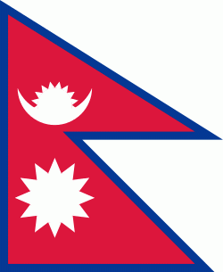
| Flag of Nepal | |
The name "Nepal" is first recorded in texts from the Vedic period of the Indian subcontinent, the era in ancient Nepal when Hinduism was founded, the predominant religion of the country. In the middle of the first millennium BC, Gautama Buddha, the founder of Buddhism, was born in Lumbini in southern Nepal. Parts of northern Nepal were intertwined with the culture of Tibet. The centrally located Kathmandu Valley is intertwined with the culture of Indo-Aryans, and was the seat of the prosperous Newar confederacy known as Nepal Mandala. The Himalayan branch of the ancient Silk Road was dominated by the valley's traders. The cosmopolitan region developed distinct traditional art and architecture. By the 18th century, the Gorkha Kingdom achieved the unification of Nepal. The Shah dynasty established the Kingdom of Nepal and later formed an alliance with the British Empire, under its Rana dynasty of premiers. The country was never colonised but served as a buffer state between Imperial China and British India. Parliamentary democracy was introduced in 1951 but was twice suspended by Nepalese monarchs, in 1960 and 2005. The Nepalese Civil War in the 1990s and early 2000s resulted in the establishment of a secular republic in 2008, ending the world's last Hindu monarchy.
Currency / Language
| ISO | Currency | Symbol | Significant figures |
|---|---|---|---|
| NPR | Nepalese rupee | ₨ | 2 |
| ISO | Language |
|---|---|
| EN | English language |
| NE | Nepali language |