Farah Province (Farāh)
Geographically the province is approximately 48000 km2, making it (comparatively) more than twice the size of Maryland, or half the size of South Korea. The province is bounded on the north by Herat, on the northeast by Ghor, the southeast by Helmand, the south by Nimroz, and on the west by Iran. It is the fourth largest province in Afghanistan by area size, but the second least densely populated province.
Shahr-e Kohne ("Old City") or Fereydun Shahr ("City of Fereydoon") is located in Farah city. This ancient city is more than 3000 years old. It was one of the ancient places of the Persian kings, as Farah belonged historically to the Iranian empires. The name "Fereydun" here refers to a hero of the Persian epic Shahnameh.
The territory was known around 500 BC as Drangiana, with Arachosia being to the east and Ariana to the north. It was part of the Median Empire followed by the Achaemenids. In 330 BC Alexander the Great took possession of the land and made it part of his empire. Upon Alexander's untimely death in 323 BC the region, along with the rest of his vast empire, was fought over by his generals all vying to be his successor. Eventually several of these were successful in carving out parts of Alexander's empire for themselves thereby becoming his official successors or Diadochi. One of these generals, Seleucus, made this region part of his domain giving it his name as the Seleucid Empire. They were replaced by other rulers and the area eventually fell to the Sassanids, then to the Arab Muslims. The Saffarids rose to power in 867 AD in Zaranj and made Farah part of their empire. By the 10th century the province became part of the Ghaznavid Empire, whose capital was located in Ghazni. They were replaced by the Ghurids and then after a century later the area saw the Mongol invasion.
The province was taken by Timur and eventually fell to the Safavid dynasty. It had been lost by the Safavids to the Uzbeks of Transoxiana, but was regained following a Safavid counter-offensive around 1600 CE, along with Herat and Sabzavar. In 1709, the Afghans gained independence from the Safavids and Farah became part of the Hotaki Empire. By 1747, it became part of Ahmad Shah Durrani's last Afghan empire. During the 19th century, the British army passed through the province to support Afghan forces in Herat Province against the invading Persians.
Following the Marxist revolution in 1978, Farah was one of the cities in which civilian massacres were carried out by the now-dominant Khalqi communists against their political, ethnic, and religious opponents. At the start of the 1980s, the majority of Farah was allied with the Harakat-i-Inqilab-i-Islami movement, but after 1981 the province split along linguistic lines, with Pashto-speaking opponents of the communist government remaining with Harakat, Group-e-Malema (Teacher Group) and Tajiks moving to the Jamiat-e Islami.
Following the 1992 collapse of the communist-backed Democratic Republic of Afghanistan, Farah Province, unlike many other provinces was relatively peaceful. Most of the Farah Mujahideen belonged to Harakat Islami of Malavi Khalas, Group-e-Malema (Teacher Group), Hizb-e-Islami and Jamiat Islami.
A 1995 Oxfam report lists Farah as "severely mined", and indicated that Farah was particularly problematic due to the wide variety of mine devices employed there, as well as usage of mines to deny access to irrigation systems. By late 1995, the stalemate broke as the Taliban counterattacked after Ismail Khan's failed drive to Kandahar, and all of Farah fell as the Taliban swept to take Herat on 5 September 1995.
Map - Farah Province (Farāh)
Map
Country - Afghanistan
 |
 |
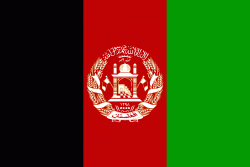
| Flag of Afghanistan | |
Human habitation in Afghanistan dates back to the Middle Paleolithic era, and the country's strategic location along the historic Silk Road has led it to being described, picturesquely, as the ‘roundabout of the ancient world’. Popularly referred to as the graveyard of empires, the land has historically been home to various peoples and has witnessed numerous military campaigns, including those by the Persians, Alexander the Great, the Maurya Empire, Arab Muslims, the Mongols, the British, the Soviet Union, and most recently by a US-led coalition. Afghanistan also served as the source from which the Greco-Bactrians and the Mughals, amongst others, rose to form major empires. The various conquests and periods in both the Iranian and Indian cultural spheres made the area a center for Zoroastrianism, Buddhism, Hinduism, and later Islam throughout history.
Currency / Language
| ISO | Currency | Symbol | Significant figures |
|---|---|---|---|
| AFN | Afghan afghani | Ø‹ | 2 |
| ISO | Language |
|---|---|
| PS | Pashto language |
| FA | Persian language |
| TK | Turkmen language |
| UZ | Uzbek language |


