Eckerö
 |
The municipality is unilingually Swedish and 0 of the population are Swedish speakers. It is the westernmost municipality of Åland and Finland. The company Eckerö Linjen operates a ferry connection between Berghamn in Storby, Eckerö and Grisslehamn on Väddö, Norrtälje in Sweden.
The municipality has previously also been known as Ekkerö in Finnish documents, but is today referred to as "Eckerö" also in Finnish.
Eckerö's most famous building is the Post and Customs house. It is the largest building that has been erected to aid the postal services between Stockholm and St. Petersburg. The building was built during the Russian era in 1828. Architect C.L Engel made the construction plans.
Map - Eckerö
Map


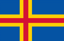
Country - Åland_Islands
 |
 |
Åland is situated in an archipelago, called the Åland Islands, at the entrance to the Gulf of Bothnia in the Baltic Sea belonging to Finland. It comprises Fasta Åland on which 90% of the population resides and about 6,500 skerries and islands to its east. Of Åland's thousands of islands, about 60–80 are inhabited. Fasta Åland is separated from the coast of Roslagen in Sweden by 38 km of open water to the west. In the east, the Åland archipelago is contiguous with the Finnish archipelago. Åland's only land border is located on the uninhabited skerry of Märket, which it shares with Sweden. From Mariehamn, there is a ferry distance of about 160 km to Turku, a coastal city of mainland Finland, and also to Stockholm, the capital of Sweden.
Currency / Language
| ISO | Currency | Symbol | Significant figures |
|---|---|---|---|
| EUR | Euro | € | 2 |
| ISO | Language |
|---|---|
| SV | Swedish language |