East Region (East Region)
The East Region has very little industry, its main commerce consisting of logging, timber, and mining. Instead, the bulk of its inhabitants are subsistence farmers. The region is thus of little political import and is often ignored by Cameroonian politicians. This coupled with the low level of development in the province have led to its being dubbed "the forgotten province".
The southwest region is the most endowed with natural resources like oil,timber and plantain plantation
Map - East Region (East Region)
Map


Country - Cameroon
 |
 |
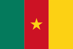
| Flag of Cameroon | |
Early inhabitants of the territory included the Sao civilisation around Lake Chad, and the Baka hunter-gatherers in the southeastern rainforest. Portuguese explorers reached the coast in the 15th century and named the area Rio dos Camarões (Shrimp River), which became Cameroon in English. Fulani soldiers founded the Adamawa Emirate in the north in the 19th century, and various ethnic groups of the west and northwest established powerful chiefdoms and fondoms. Cameroon became a German colony in 1884 known as Kamerun. After World War I, it was divided between France and the United Kingdom as League of Nations mandates. The Union des Populations du Cameroun (UPC) political party advocated independence, but was outlawed by France in the 1950s, leading to the national liberation insurgency fought between French and UPC militant forces until early 1971. In 1960, the French-administered part of Cameroon became independent, as the Republic of Cameroun, under President Ahmadou Ahidjo. The southern part of British Cameroons federated with it in 1961 to form the Federal Republic of Cameroon. The federation was abandoned in 1972. The country was renamed the United Republic of Cameroon in 1972 and back to the Republic of Cameroon in 1984 by a presidential decree by president Paul Biya. Paul Biya, the incumbent president, has led the country since 1982 following Ahidjo's resignation; he previously held office as prime minister from 1975 on. Cameroon is governed as a Unitary Presidential Republic.
Currency / Language
| ISO | Currency | Symbol | Significant figures |
|---|---|---|---|
| XAF | Central African CFA franc | Fr | 0 |
| ISO | Language |
|---|---|
| EN | English language |
| FR | French language |