Map - Diffa Region (Diffa)

Diffa Region (Diffa)
Diffa is one of the seven Regions of Niger, located in the southeast of the country. The capital of the region is Diffa.

Diffa Region is situated in the extreme southeast of Niger between 10° 30’ and 15° 35’ longitude East and 13° 04’ and 18° 00’ latitude North. It covers 156 906 km², and it borders Agadez Region to the north, Chad to the east, Nigeria to the south, and Zinder Region to the west. The landscape is primarily Sahelian in the south, merging into the Sahara desert in the north of the region. In the far southeast can be found Niger's portion of Lake Chad; formerly extending as far west as N'guigmi, the lake has shrunk drastically in recent decades. In the southeast the Komadougou Yobe river forms part of the border with Nigeria.

 
Map - Diffa Region (Diffa)
Map
Google Earth - Map - Diffa Region
Google Earth
Openstreetmap - Map - Diffa Region
Openstreetmap
Map - Diffa Region - Esri.WorldImagery
Esri.WorldImagery
Map - Diffa Region - Esri.WorldStreetMap
Esri.WorldStreetMap
Map - Diffa Region - OpenStreetMap.Mapnik
OpenStreetMap.Mapnik
Map - Diffa Region - OpenStreetMap.HOT
OpenStreetMap.HOT
Map - Diffa Region - OpenTopoMap
OpenTopoMap
Map - Diffa Region - CartoDB.Positron
CartoDB.Positron
Map - Diffa Region - CartoDB.Voyager
CartoDB.Voyager
Map - Diffa Region - OpenMapSurfer.Roads
OpenMapSurfer.Roads
Map - Diffa Region - Esri.WorldTopoMap
Esri.WorldTopoMap
Map - Diffa Region - Stamen.TonerLite
Stamen.TonerLite
Country - Niger
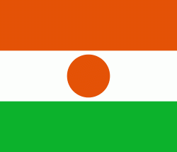
Flag of Niger
Niger or the Niger, officially the Republic of the Niger (République du Niger, Jamhuriyar Nijar), is a landlocked country in West Africa. It is a unitary state bordered by Libya to the northeast, Chad to the east, Nigeria to the south, Benin and Burkina Faso to the southwest, Mali to the west, and Algeria to the northwest. It covers a land area of almost 1,270,000 km2, making it the largest landlocked country in West Africa. Over 80% of its land area lies in the Sahara. Its predominantly Muslim population of about million live mostly in clusters in the further south and west of the country. The capital Niamey is located in Niger's southwest corner.

It is one of the least developed countries and is also one of the poorest countries in the world by GDP per capita. Some non-desert portions of the country underwent periodic drought and desertification. The economy is concentrated around subsistence agriculture, with some export agriculture in the less arid south, and export of raw materials, including uranium ore. It faces challenges to development due to its landlocked position, desert terrain, low literacy rate, jihadist insurgencies and the world's highest fertility rates due to birth control not being used and the resulting rapid population growth.
Currency / Language  
ISO Currency Symbol Significant figures
XOF West African CFA franc Fr 0
Neighbourhood - Country  
  •  Algeria 
  •  Benin 
  •  Burkina Faso 
  •  Chad 
  •  Libya 
  •  Mali 
  •  Nigeria 
Administrative Subdivision
Country, State, Region,...
City, Village,...