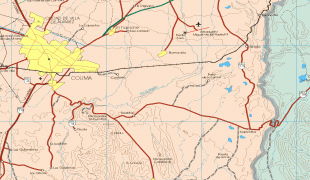
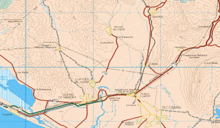
Colima (Estado de Colima)
 |
 |
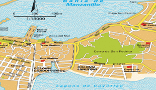
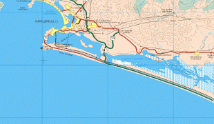
Colima is a small state of western Mexico on the central Pacific coast, and includes the four oceanic Revillagigedo Islands. Mainland Colima shares borders with the states of Jalisco and Michoacán. In addition to the capital city of Colima, the main cities are Manzanillo and Tecomán. Colima is the fourth smallest state in Mexico and has the second smallest population, but has one of Mexico's highest standards of living and the lowest unemployment. However, Colima is also the state with the highest murder rate per capita and one of the highest crime rates, due to its ports being a contested area for cartels.
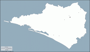
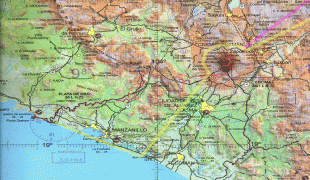
The state covers a territory of 5,455 km2 and is the fourth smallest federal entity after Tlaxcala, Morelos and the Federal District of Mexico City, containing only 0.3% of the country's total territory. The state is in the middle of Mexico's Pacific coast, bordered by the Pacific Ocean and the states of Jalisco and Michoacán.
Colima's territory includes the Revillagigedo Islands—Socorro, San Benedicto, Clarión, and Roca Partida. These are under federal jurisdiction but are considered part of the municipality of Manzanillo.
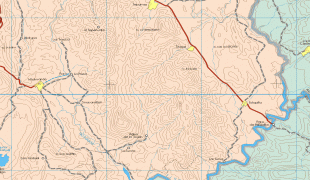
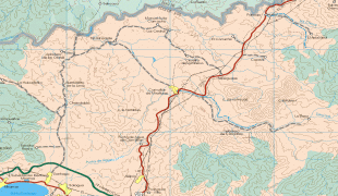
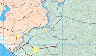
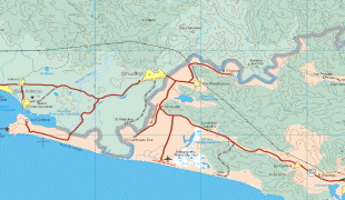
Politically, the state is divided into ten municipalities. Natural geography divides the state into a northern and southern region. The north has a cooler climate due to the higher mountains. The south is hotter and includes the Pacific Ocean coastline. The Revillagigedo Islands, of volcanic origin, are dispersed along the 19° north parallel over an area of about 400 km2—with a total landmass of 205 km2.
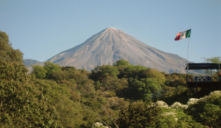
The altitude varies from sea level to 3,839 m (12,595 ft) at the crater of the Volcán de Colima.
The state is in an offshoot of the Sierra Madre Occidental mountain range and geographically consists of four mountain systems. The most important of these is the Cerro Grande and its related peaks of Jurípicho-Juluapan, Los Juanillos, La Astilla, El Ocote, El Peón, El Barrigón, San Diego, and La Media Luna. The second consists of mountain chains parallel to the coast between the Marabasco and Armería Rivers, which include El Espinazo del Diablo, El Escorpión, El Tigre, El Aguacate, El Centinela, El Tora and La Vaca. The third is located between the Armería and Salado Rivers and includes the Alcomún y Partida, San Miguel y Comala and San Gabriel/Callejones peaks. The last is between the Salado and Naranjo or Coahuayana Rivers and contains small mountain chains such as the Piscila, Volcancillos, La Palmera, El Camichín and Copales. Three quarters of the state is covered by mountains and hills.
At the very north of the state, the border is marked by two volcanoes. The Colima Volcano, also called the Volcán de Fuego, is active and the Nevado de Colima is not. The Nevado de Colima is taller at 4,271 m (14,013 ft) and gives its name to the national park that surrounds it. The Colima Volcano, 3825 m (12,549 ft), has a pyramidal peak, in contrast to the other, which has been leveled somewhat. The last major eruptions of the Colima Volcano occurred in 1998 and 1999.
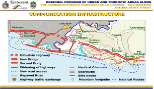
The main rivers of the state are the Cihuatlán River, also called the Chacala, Marabasco, or Paticajo, which forms the state's border with Jalisco on the west; the Armería, which descends from the Sierra de Cacoma and crosses the state north-south into the Pacific, and the Coahuayana River, which forms Colima's eastern border with Michoacán. The Salado is another important river, which flows entirely within Colima before emptying into the Coahuayana. Many of the state's streams and arroyos empty into the Salado.
Colima has a relatively short coastline, at 139 km (1.2% of Mexico's total). It extends from the Boca de Apiza to the Cerro de San Francisco in front of Barra de Navidad, Jalisco.
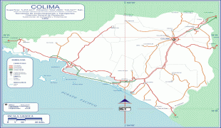
Map - Colima (Estado de Colima)
Map


Country - Mexico


Currency / Language
| ISO | Currency | Symbol | Significant figures |
|---|---|---|---|
| MXV | Mexican Unidad de Inversion | 2 | |
| MXN | Mexican peso | $ | 2 |
| ISO | Language |
|---|---|
| ES | Spanish language |