Map - Bremen (state) (Bremen)

Bremen  (Bremen)
Bremen, officially the Free Hanseatic City of Bremen (Freie Hansestadt Bremen; Free Hansestadt Bremen), is the smallest and least populous of Germany's 16 states. It is informally called Land Bremen ("State of Bremen"), although the term is sometimes used in official contexts. The state consists of the city of Bremen and its seaport exclave, Bremerhaven, surrounded by the larger state of Lower Saxony in northern Germany.

The state of Bremen consists of two non-contiguous territories. These enclaves contain Bremen, officially the 'City' (Stadtgemeinde Bremen) which is the state capital, and the city of Bremerhaven (Stadt Bremerhaven). Both are located on the River Weser; Bremerhaven ("Bremen's harbour") is further downstream on the mouth of the Weser with open access to the North Sea. Both enclaves are completely surrounded by the neighbouring State of Lower Saxony (Niedersachsen). The highest point in the state is in Friedehorst Park (32.5m).

 
Map - Bremen  (Bremen)
Map
Google Earth - Map - Bremen (state)
Google Earth
Openstreetmap - Map - Bremen (state)
Openstreetmap
SC06_map_large.jpg
2077x1653
conference.spatial-c...
bremen-map-0.jpg
1500x1874
www.orangesmile.com
Bremen-Tourist-Map-2...
1500x1874
www.mappery.com
Bremen-Verden1655.jp...
1644x1398
upload.wikimedia.org
Bremen_Map_1910.jpg
1627x1198
upload.wikimedia.org
bremen-map-2008.png
1512x1168
ymtram.mashke.org
bremen-map-tram-big....
1512x1168
www.orangesmile.com
bremen-map-big.jpg
1357x1229
www.orangesmile.com
karte-1-570.gif
1325x1137
www.welt-atlas.de
Stadtplan-Bremen-569...
1000x1000
www.hot-map.com
Landkarte-Bremen-827...
1000x1000
www.hot-map.com
Stadtplan-Bremerhave...
1000x1000
www.hot-map.com
Map-Bremen-Brockhaus...
1163x754
upload.wikimedia.org
Map-Bremen-Brockhaus...
1163x754
upload.wikimedia.org
Bremen_Old_Map_5.jpg
978x833
upload.wikimedia.org
Bremen-map.jpg
840x958
www.zonu.com
Bremen_Old_Map_2.jpg
993x680
upload.wikimedia.org
Bremen_Old_Map_4.jpg
997x638
upload.wikimedia.org
Bremen_Old_Map.jpg
995x636
upload.wikimedia.org
karte-1-651.gif
681x729
www.welt-atlas.de
Country - Germany
Flag of Germany
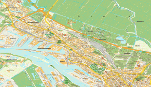
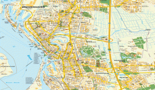
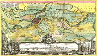
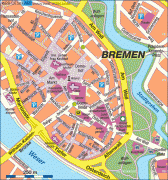
Germany, officially the Federal Republic of Germany, is a country in Central Europe. It is the second-most populous country in Europe after Russia, and the most populous member state of the European Union. Germany is situated between the Baltic and North seas to the north, and the Alps to the south; it covers an area of 357022 km2, with a population of almost 84 million within its 16 constituent states. Germany borders Denmark to the north, Poland and the Czech Republic to the east, Austria and Switzerland to the south, and France, Luxembourg, Belgium, and the Netherlands to the west. The nation's capital and most populous city is Berlin and its financial centre is Frankfurt; the largest urban area is the Ruhr.

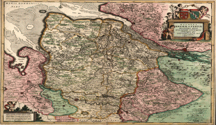
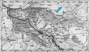
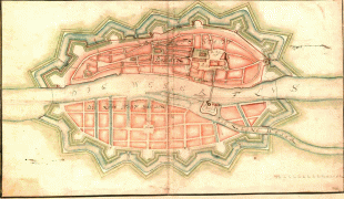
Various Germanic tribes have inhabited the northern parts of modern Germany since classical antiquity. A region named Germania was documented before AD 100. In 962, the Kingdom of Germany formed the bulk of the Holy Roman Empire. During the 16th century, northern German regions became the centre of the Protestant Reformation. Following the Napoleonic Wars and the dissolution of the Holy Roman Empire in 1806, the German Confederation was formed in 1815.
Currency / Language  
ISO Currency Symbol Significant figures
EUR Euro € 2
ISO Language
DE German language
Neighbourhood - Country  
  •  Austria 
  •  Belgium 
  •  Czech Republic 
  •  Denmark 
  •  France 
  •  Luxembourg 
  •  Netherlands 
  •  Poland 
  •  Switzerland 
Administrative Subdivision
Country, State, Region,...
City, Village,...
Airport