Bossangoa
Bossangoa is the capital of Ouham, one of the 14 prefectures of the Central African Republic. The town has a population of 36,478 (2003 census). It is located 303 km (189 mi) north of the country's capital, Bangui. The Ouham River passes through Bossangoa and on through a number of waterfalls east of the city before turning north to join the Chari River in Chad.
The Mandjia, the third most populous ethnic group in the Central African Republic, are concentrated in Bossangoa. Along with the Baya, a closely related group, the Mandjia are important historically for their resistance to invasion by various Muslim powers to the north. From 1901 to 1905 Bossangoa and the surrounding area was in rebellion against French colonial authorities. Bossangoa became a center of Protestant missionary activity during the 1920s. In 1959, the city was made the seat of the Apostolic Prefecture of Bossangoa from the Diocese of Berbérati. In 1964, it was promoted as the Diocese of Bossangoa. In June 1980 the city was the scene of clashes between police and farmers over government food policies. The next year French troops were called in to suppress rioting in the aftermath of elections.
There is a small local airport that serves light planes. The main agricultural products are cotton and coffee.
Bossangoa has a tropical savanna climate (Köppen climate classification Aw).
Map - Bossangoa
Map
Country - Central_African_Republic
 |
 |
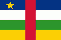
| Flag of the Central African Republic | |
The Central African Republic covers a land area of about 620000 km2. , it had an estimated population of around million. , the Central African Republic is the scene of a civil war, which is ongoing since 2012.
Currency / Language
| ISO | Currency | Symbol | Significant figures |
|---|---|---|---|
| XAF | Central African CFA franc | Fr | 0 |
| ISO | Language |
|---|---|
| FR | French language |
| KG | Kongo language |
| LN | Lingala language |
| SG | Sango language |


