Binh Duong province (Tỉnh Bình Dương)
Bình Dương is considered to be the gateway to HCMC, the economic cultural centre of the country. Endowed with convenient geography conditions, Bình Dương has an extremely important road network. Major highways of the country cross Bình Dương such as National Road (NR) no. 13, NR no. 14, the HCMC Route and the Trans-Asian Highway. Bình Dương is only 10-15 km from Tân Sơn Nhất International Airport and important ports. All of the advantages create favourable conditions to achieve social and economic development.
Bình Dương province is situated on relatively level terrain, and is crossed by the Saigon, Đồng Nai, and Bé rivers. It also has some hills. Bình Dương can be seen from the Lái Thiêu central church. Although Bình Dương is flat, it is higher than Ho Chi Minh City. Across Bình Dương there are many different topographic regions, including low mountainous terrain with slight undulation, flat plains and alluvial valleys. There are some low mountains, including Châu Thới in Dĩ An and Cậu mountain (also called Lấp Vò) in Dầu Tiếng district and some low hills. Natural effects have created many different types of landform including worn areas, accumulative areas (due to the deposition of corrosive materials in the flow) and some areas that are worn, accumulative and depositional at the same time. This is due to rainfall and the flow affecting the ground, with the effects of wind, temperature, climate, the erosion and collapse due to gravity of the geology. The impact took place over millions of years.
Map - Binh Duong province (Tỉnh Bình Dương)
Map
Country - Vietnam
 |
 |
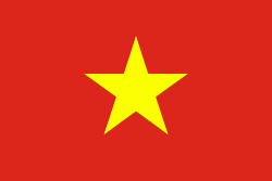
| Flag of Vietnam | |
Vietnam was inhabited by the Paleolithic age, with states established in the first millennium BC on the Red River Delta in modern-day northern Vietnam. The Han dynasty annexed Northern and Central Vietnam under Chinese rule from 111 BC, until the first dynasty emerged in 939. Successive monarchical dynasties absorbed Chinese influences through Confucianism and Buddhism, and expanded southward to the Mekong Delta, conquering Champa. The Nguyễn—the last imperial dynasty—surrendered to France in 1883. Following the August Revolution, the nationalist Viet Minh under the leadership of communist revolutionary Ho Chi Minh proclaimed independence from France in 1945.
Currency / Language
| ISO | Currency | Symbol | Significant figures |
|---|---|---|---|
| VND | Vietnamese đồng | ₫ | 0 |
| ISO | Language |
|---|---|
| KM | Central Khmer language |
| ZH | Chinese language |
| EN | English language |
| FR | French language |
| VI | Vietnamese language |


