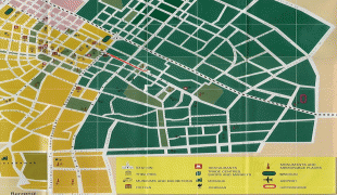
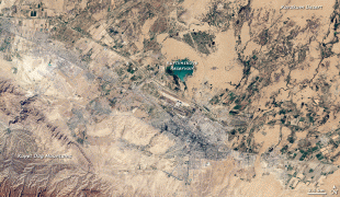
Ashgabat
 |
The city was founded in 1881 on the basis of an Ahal Teke tribal village, and made the capital of the Turkmen Soviet Socialist Republic in 1924. Much of the city was destroyed by the 1948 Ashgabat earthquake, but has since been extensively rebuilt under the rule of Saparmurat Niyazov's "White City" urban renewal project, resulting in monumental projects sheathed in costly white marble. The Soviet-era Karakum Canal runs through the city, carrying waters from the Amu Darya from east to west. Since 2019, the city has been recognized as having one of the highest costs of living in the world largely due to Turkmenistan's inflation and import issues.
Ashgabat is called Aşgabat in Turkmen, (Ашхабад) in Russian from 1925 to 1991, and عشقآباد in Persian. Before 1991, the city was usually spelled Ashkhabad in English, a transliteration of the Russian form. It has also been variously spelled Ashkhabat and Ashgabad. From 1919 until 1927, the city was renamed Poltoratsk after a local revolutionary, Pavel Gerasimovich Poltoratskiy.
Although the name literally means "city of love" or "city of devotion" in modern Persian, the name might be modified through folk etymology. Turkmen historian Ovez Gundogdiyev believes that the name goes back to the Parthian era, 3rd century BC, deriving from the name of the founder of the Parthian Empire, Arsaces I of Parthia, in Persian Ashk-Abad (the city of Ashk/Arsaces).
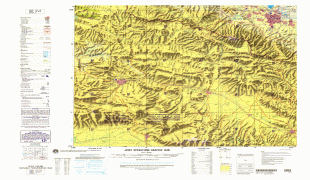
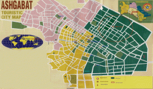
Map - Ashgabat
Map


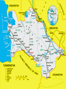
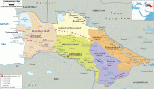
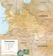

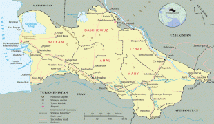


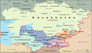
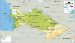
Country - Turkmenistan
 |
 |
| Flag of Turkmenistan | |
Turkmenistan has long served as a thoroughfare for other nations and cultures. Merv is one of the oldest oasis-cities in Central Asia, and was once the biggest city in the world. It was also one of the great cities of the Islamic world and an important stop on the Silk Road. Annexed by the Russian Empire in 1881, Turkmenistan figured prominently in the anti-Bolshevik movement in Central Asia. In 1925, Turkmenistan became a constituent republic of the Soviet Union, the Turkmen Soviet Socialist Republic (Turkmen SSR); it became independent after the dissolution of the Soviet Union in 1991.
Currency / Language
| ISO | Currency | Symbol | Significant figures |
|---|---|---|---|
| TMT | Turkmenistan manat | m | 2 |
| ISO | Language |
|---|---|
| RU | Russian language |
| TK | Turkmen language |
| UZ | Uzbek language |